A Good Friend to the Rescue

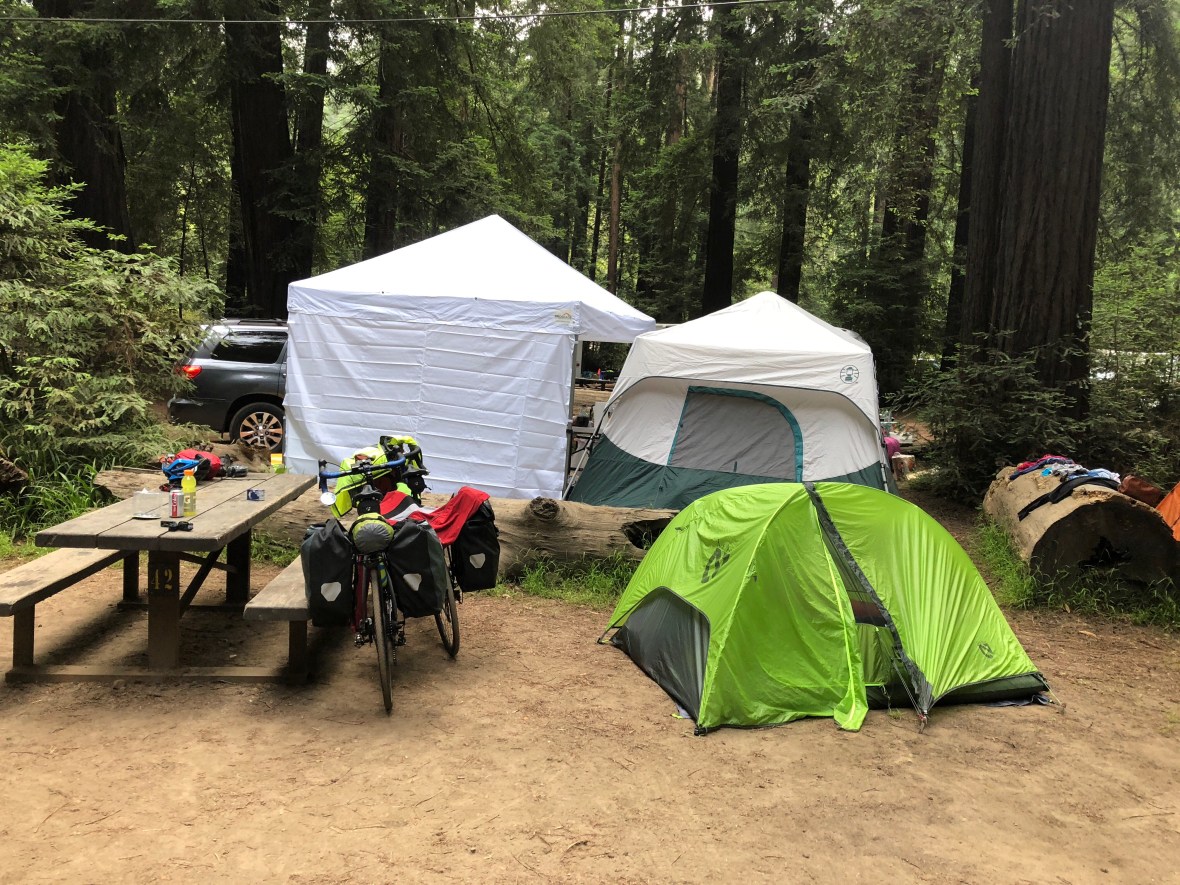
It’s decided: this will be the last time we camp on this trip — the tent’s just too small and close to the ground for a restful night’s sleep. And we had to pitch it on dirt, in close proximity to a family whose kids were having a screaming contest. OK, it was pretty, there were redwoods, hot showers, a pub just a few minutes’s walk down the road, but …

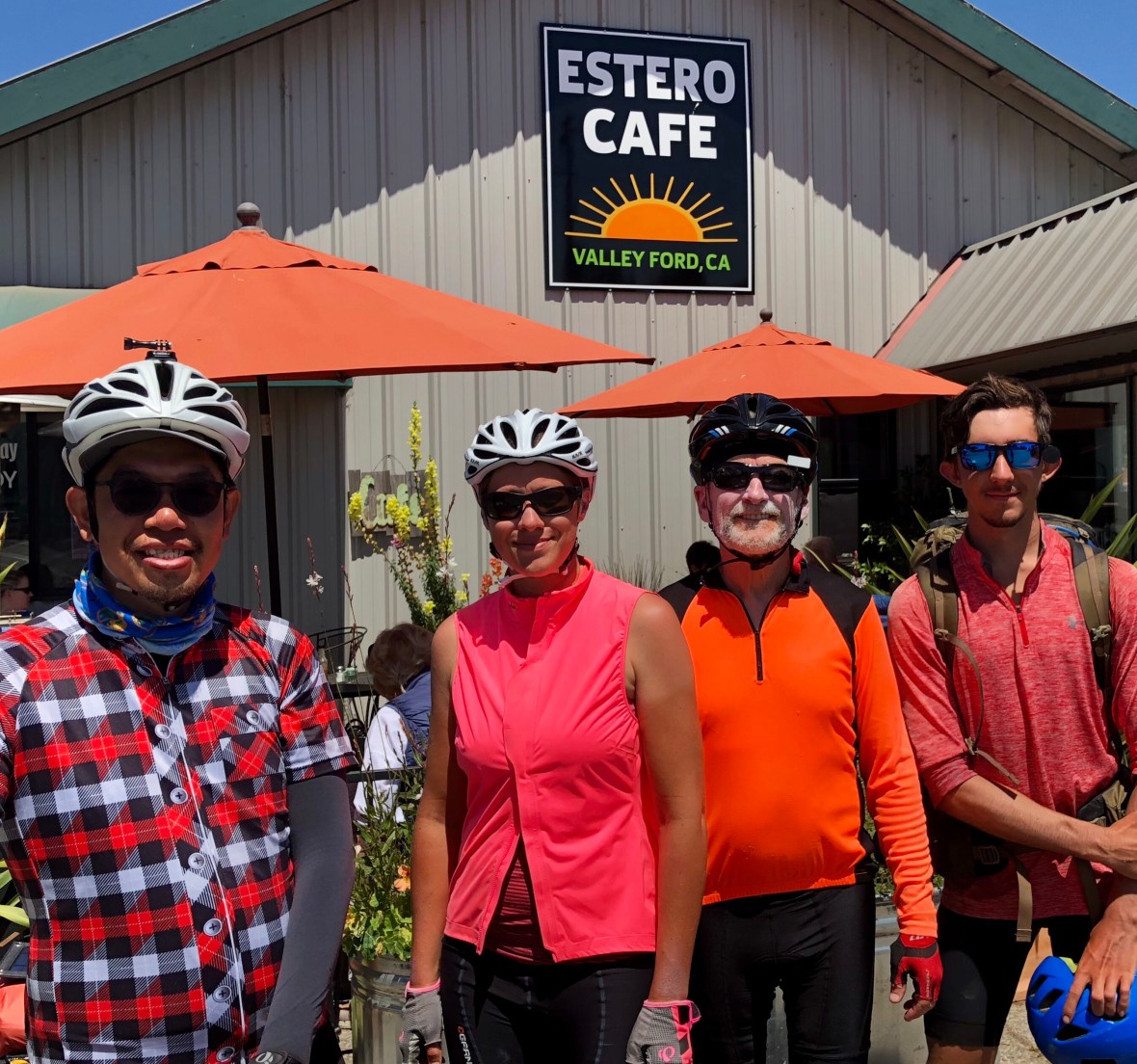
We packed up and pedaled from the campground a few minutes south to Ripplewood Resort for what was billed as “the most overlooked breakfast on the Big Sur Coast”: eggs benedict with a chile Hollandaise and good ol’ blueberry pancakes with a couple over easy. A sign on the cafĂ© door warned “If It’s Urban, It’s Disturbin’.”

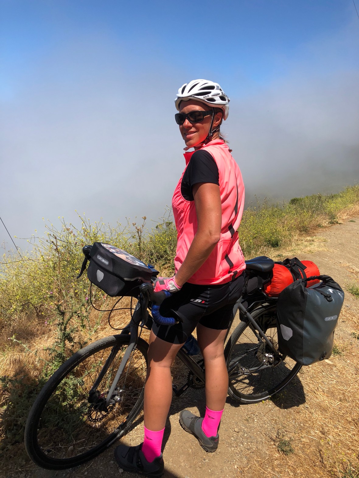
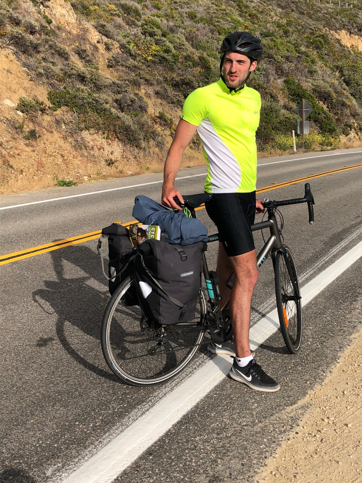
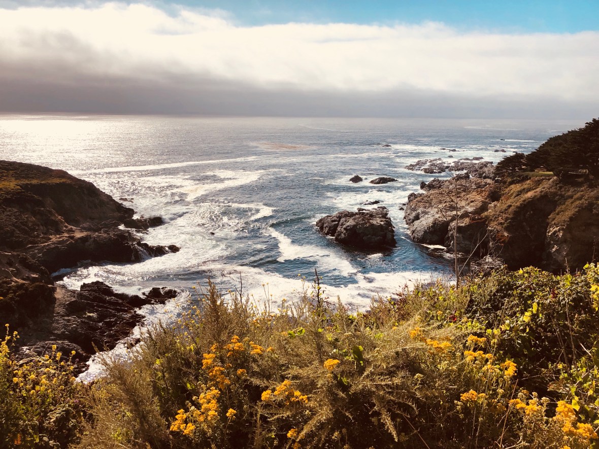
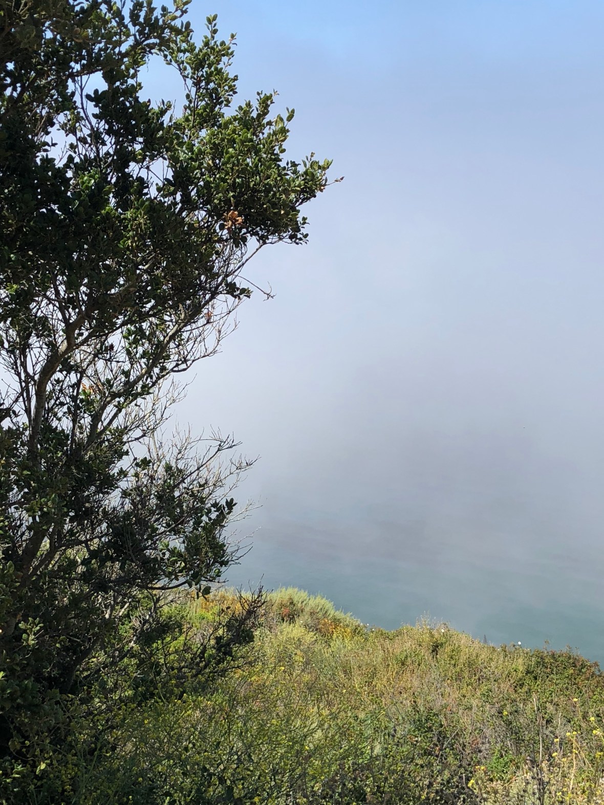
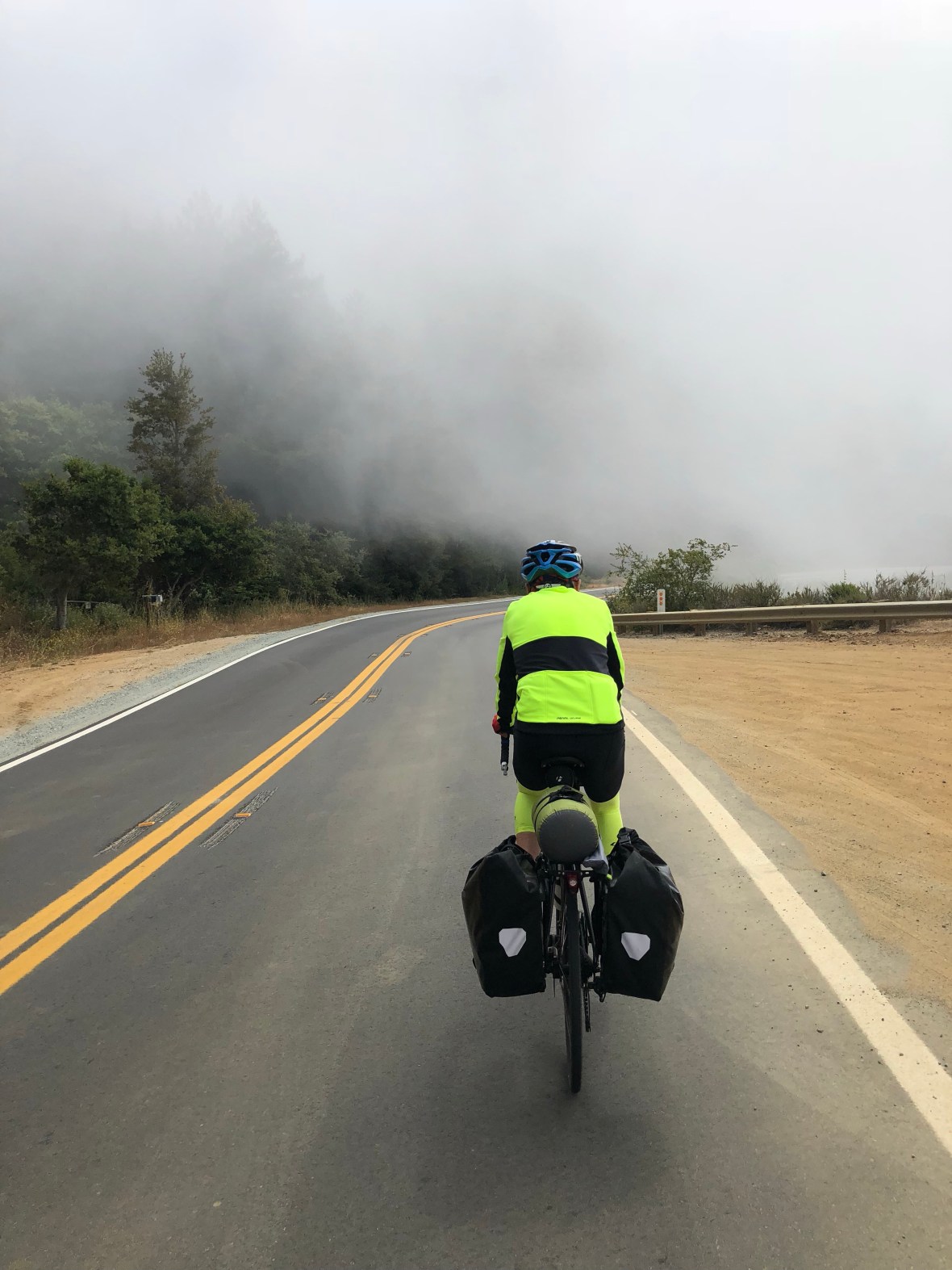
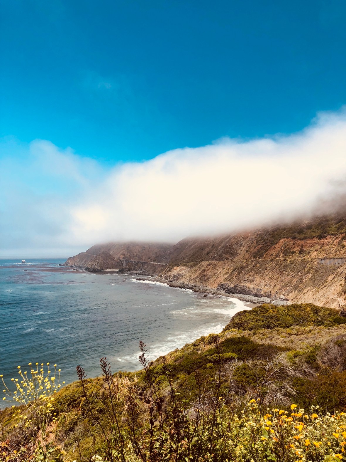
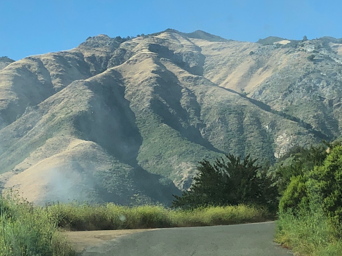
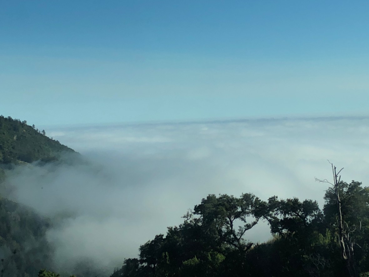
Day 26 dawned hot and sunny at first, as we climbed out of the Big Sur River, but within a few miles the Pacific fog moved in and cooled us off. We rode through the clouds, which swirled like smoke up the sheer drop offs, all around us the brilliance of blue sky and sunshine only thinly veiled in white mist.

That’s the ocean way down there.

“Here it comes…”

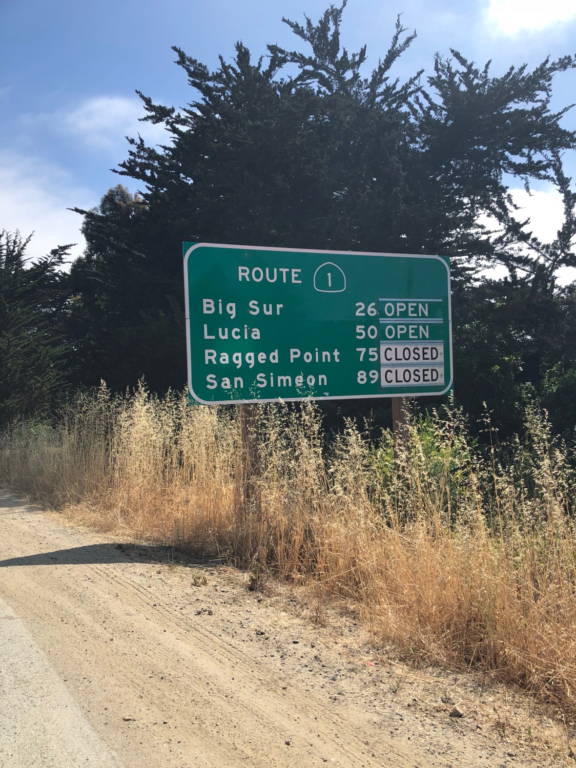
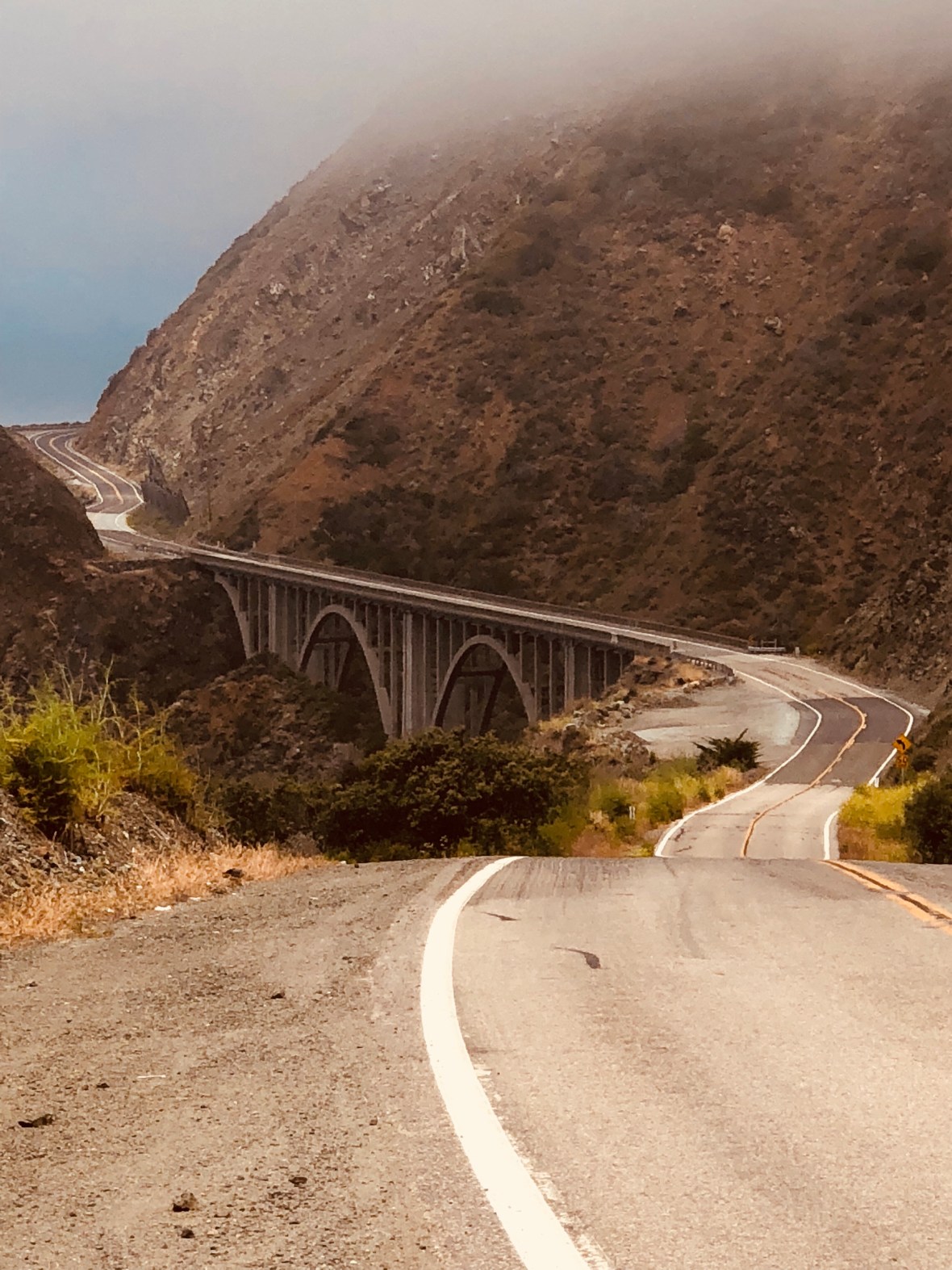
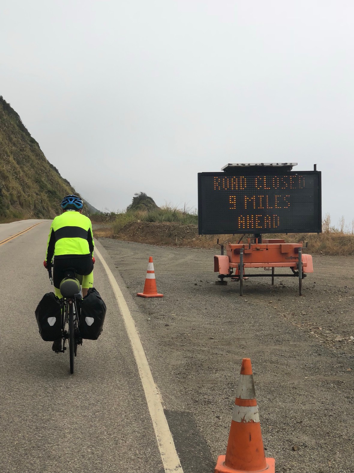
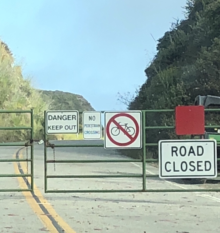
Only problem with this cool beauty was that the views were then largely obscured, which probably saved us some time since there was little point to pause at every vista point for photo ops, a persistent cause of slow progress yesterday. We made good time, in part because, due to the road closure further south, fewer cars than usual were passing us. It often felt as if we had Hwy 1 to ourselves, a private and spectacularly engineered bike path.

Yep, that was short but steep.

Road closure or not — and it’s scheduled to reopen in a month — Big Sur still feels remote, even when it’s crowded with summer visitors. Ever since the road opened in the late 1930s, this area has been popular with artists, hermits, and others seeking creative or spiritual solitude not too far from civilization. In the late 1950s Beat writer Jack Kerouac, overwhelmed by public attention in the wake of his wildly successful debut On the Road, fled to San Francisco in an alcoholic haze and took a bus to Big Sur, walking the last uphill miles to a cabin he borrowed from poet Lawrence Ferlinghetti, where he tried to practice Buddhism, feeding the animals instead of eating them, drinking heavily, and slowly going crazy (as chronicled in his semi-autobiographical Big Sur).

Kerouac’s hideout, in Bixby Canyon.

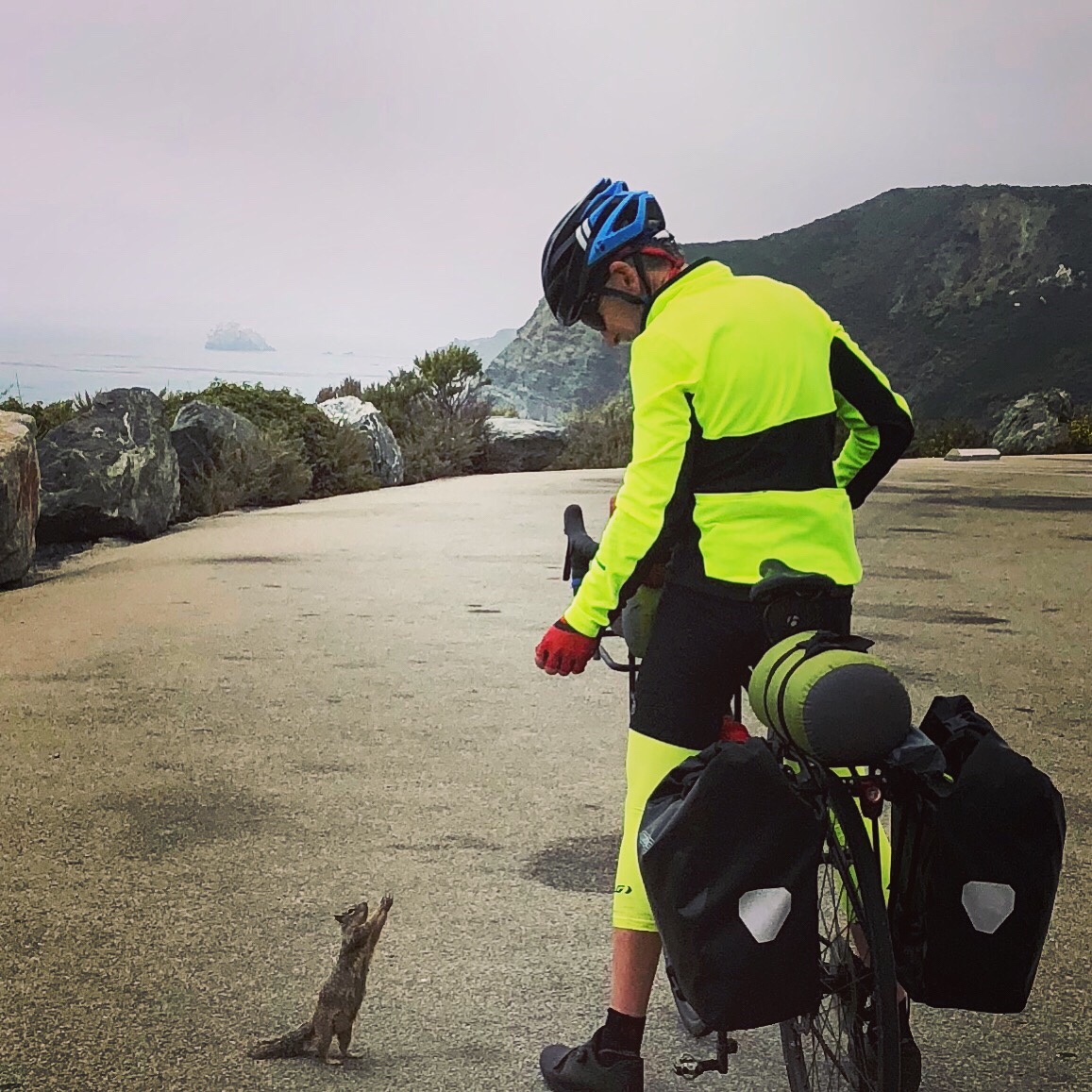
David unfortunately had nothing in his bag that was good for this cute little panhandler.

A near-contemporary of Kerouac’s, Henry Miller also lived at Big Sur while his literary reputation was benefiting from Tropic of Cancer and other racy books banned at the time in the US. His residence here was longer (1944-62) and more productive than Kerouac’s, and led to the memoir Big Sur and the Oranges of Hieronymus Bosch, in which he chronicles the area’s emergence as an artists’ colony and complains about the growing tourist traffic that distracted him from his writing. Like Ferlinghetti, he also invited a troubled friend to his cabin, who ended up hating the weather and the seclusion and having to chop your own firewood. The Henry Miller Memorial Library in the town of Big Sur was closed when we rode through, due to the road closure, but it may not have mattered: its motto is “a place where nothing happens.”

Turnoff to the “New Camaldoni Hermitage”

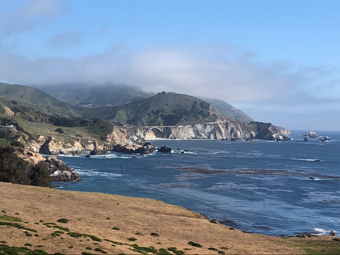
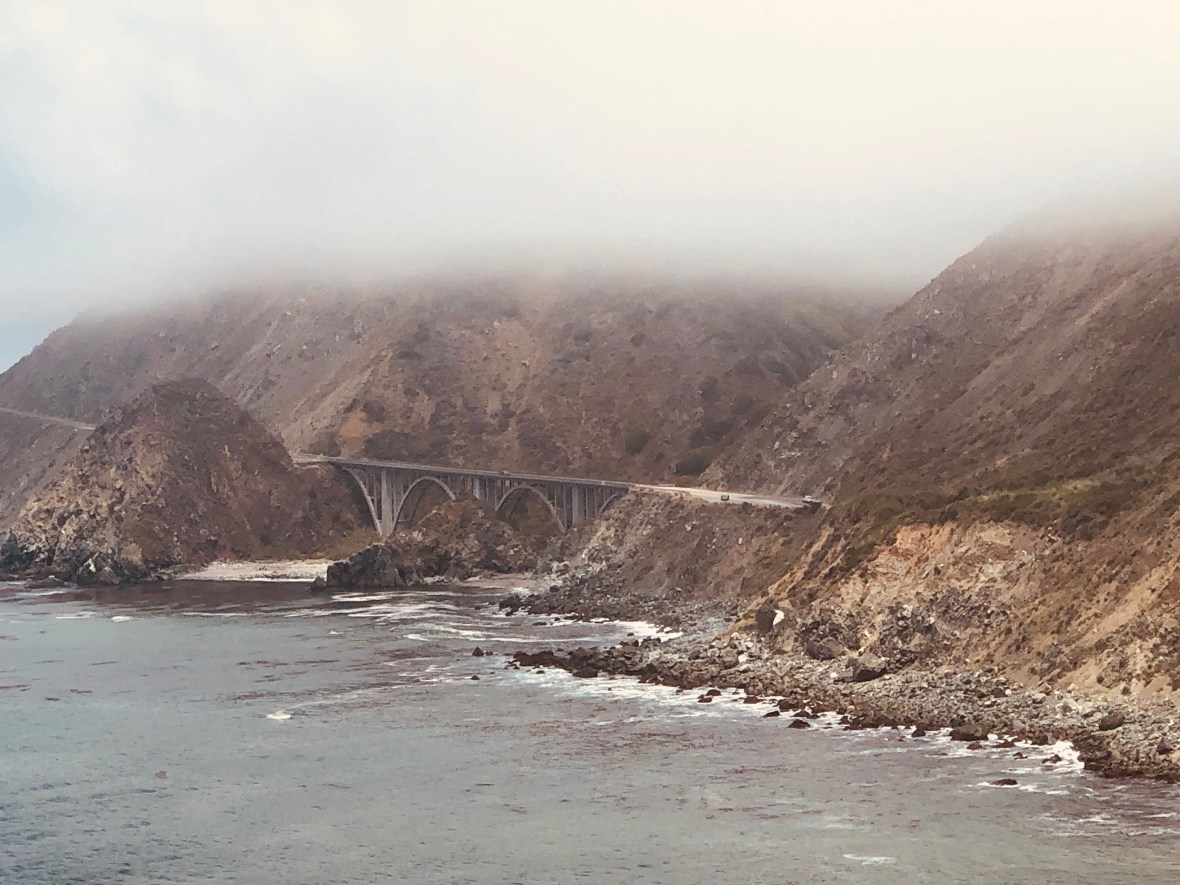
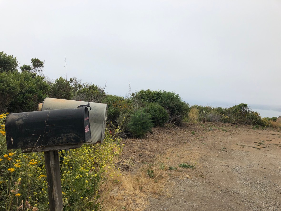
The civil engineering masterpiece along which we rode was completed only seven years before Miller moved here, built in large part by convicts from San Quentin and Folsom prisons. Now Hwy 1 is lined with expensive resorts, art galleries, private and public campgrounds, and hulking, almost ominous James-Bond-villain gates to hidden cliffside homes and compounds of the rich and perhaps famous — names like “Rancho Rico,” “Casa de Oro,” and “Bien Sur” — plus the odd and very steep sometimes unpaved driveway leading up into the hills, sometimes marked with a mailbox or a “Private” sign, where perhaps the next Great American Novelist plies her trade in splendid and scenic seclusion, punctuated by occasional nights out at Nepenthe or deep bodywork in the Esalen hot springs pools.

There were no visible driveways or access roads anywhere near here.

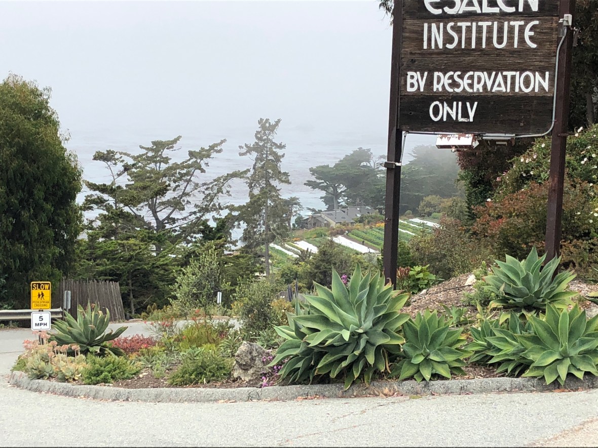
Esalen: rooms start at $845/night, but you can pitch a sleeping bag for only $420. (Our Big Sur tent site last night was $65.)

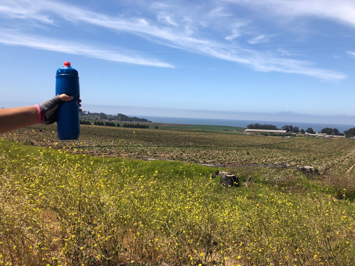
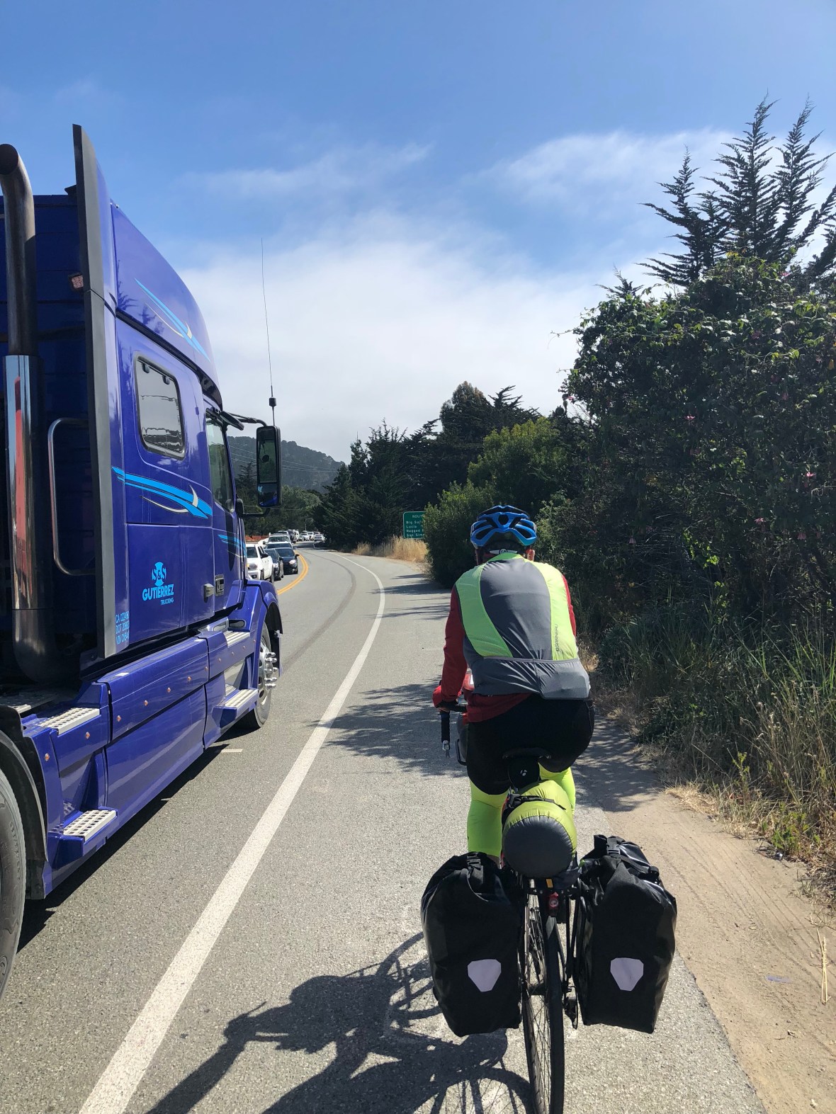
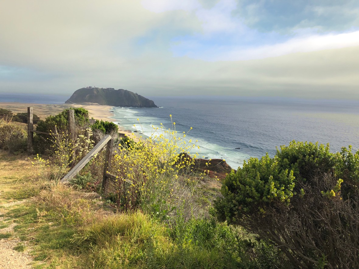
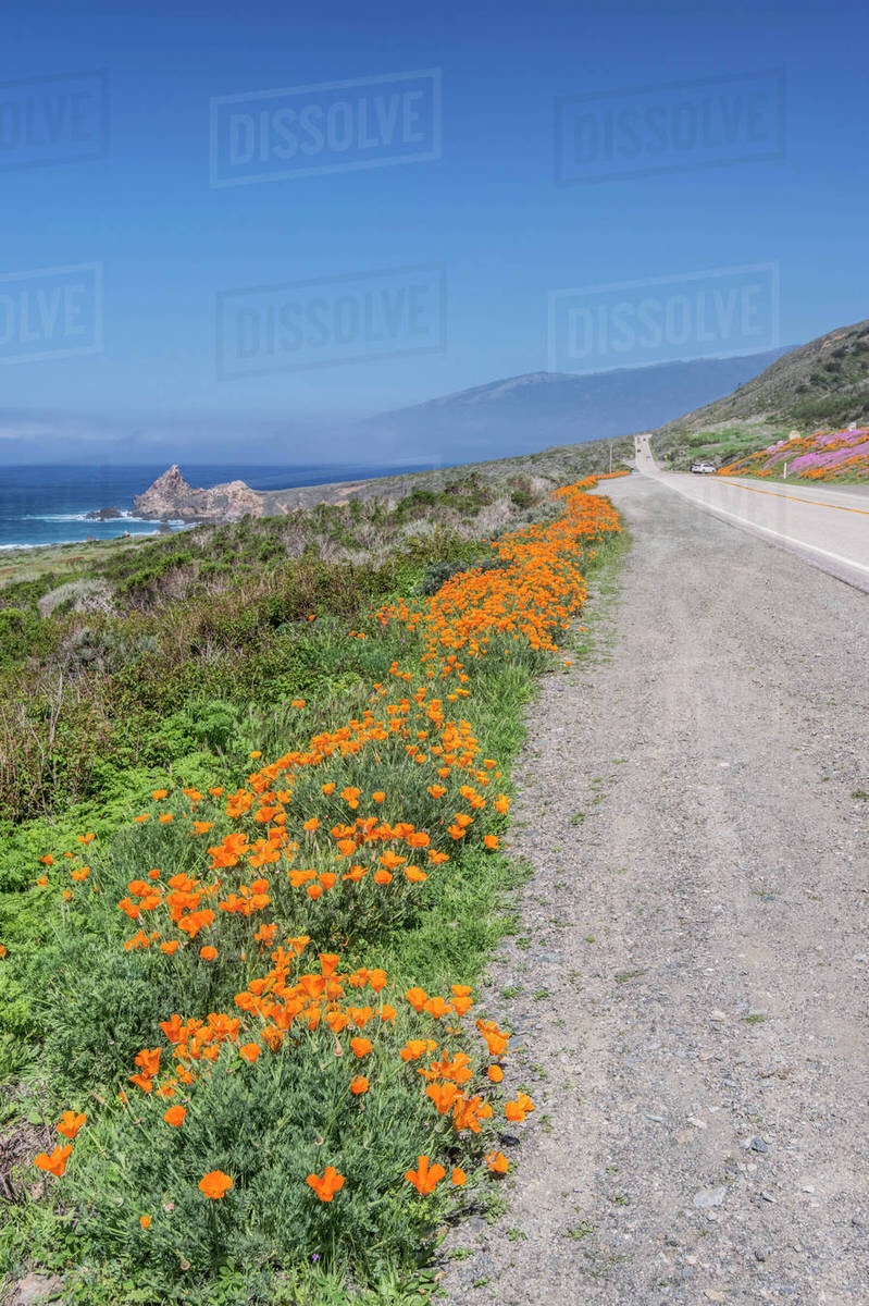
Traffic was light, as previously noted, and the road in great shape with good shoulders, plenty of turnouts. and reasonable grades, so riding was a real pleasure. So were the displays of late-spring early-summer flowers: paintbrush, wild roses, lupine, mullein, wild mustard (everywhere) and, among others, naturally, the California state flower.

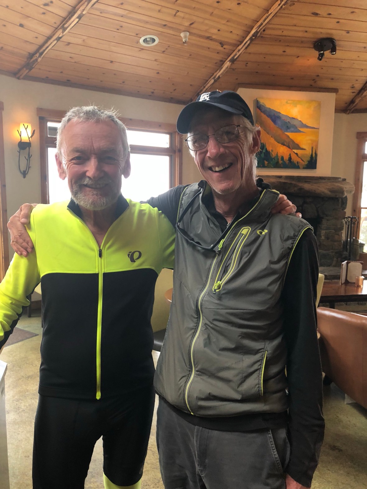
Equally pleasurable was our arrival at Treebones, a few hundred meters from the road closure at Gorda, where after a (at first glance, disheartening) short steep climb among yurts and treehouses we were greeted most cordially by the staff of this “glamping” resort where we bought beers from the gift shop, lounged on a very comfortable sofa by a fireplace, watched the fog swirl below us, and awaited our friend Tom.

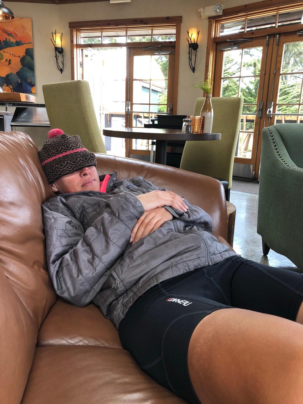
Ashley is cozy, thanks to the loan of Tom’s warm micro-puff.

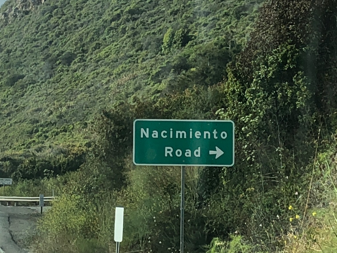
Tom, having driven down from Santa Cruz in an unbelievably generous act of friendship, had a drink and appetizers with us, then loaded our bikes into his truck and drove us on the steep and narrow Nacimiento Road, the only way around the closure. Climbing that impossibly steep winding road, a lane-and-a-half-wide and hardly untrafficked, we could only think how unutterably miserable it would be to do that on a bike. Rough terrain, a long punishing ride, and no services. But for the selflessness of Tom….

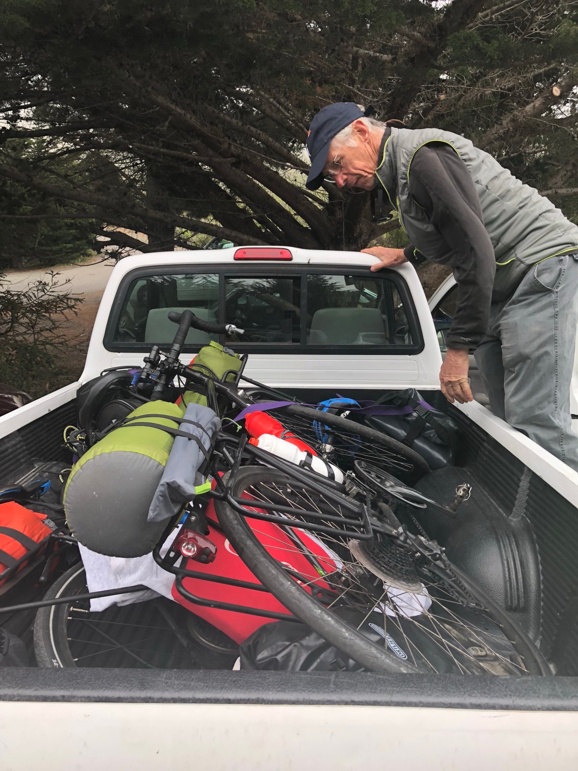
We drove over the Santa Lucias to 101, south to Paso Robles where we paused for a Mexican dinner, then back out to the coast where we’d reserved a room on the other side of the closure, at San Simeon. All in all, well over a 100-mile detour. Tom had brought some vino, which we sipped while unpacking and repacking for the morrow and chatting. Called it a night around 11, after gathering all the camping stuff we’re offloading with Tom–who has, kindness upon kindness, offered to store it for us until the next time….


Today: 39.5 miles, 4018′, 3:47. Plus one long drive across beautiful California roads that were almost all new to all three of us.

Rested and ready

In the immortal words of “Clive,” as we’ll call him, a British bike tourist we met at a scenic overlook on the Big Sur coast this afternoon, “this day really got its sh*t together.” Clive, who began his ride in Astoria and is LA-bound, describes himself as “not risk-averse,” and so he intends to hit the Esalen hot pools at 1am and sneak his bike over the Gorda-to-Ragged Point road closure.

Our own day started with the free motel breakfast in Santa Cruz and retrieving our bikes from the storage closet to repack them and roll back out on the road for this 25th day of our tour by a few minutes past 9am. It has turned sunny, or as sunny as the Central Coast usually gets, and the wind had quartered (or however the old salt sailors say it) so it was more of a sidewind than a headwind.

Ironically, it was on Freedom Blvd that Ashley had to stop and schedule an appointment with the dean. “This is my life now,” she lamented.

A quick stop in Aptos, nine miles later, so Ashley could mail her grandmother a birthday present and send home some stuff we forgot to give Winona & Sergio yesterday. Trying to lighten our loads! Next door to the PO was a discount sports equipment shop and we bought four new water bottles because, upon inspection this morning, our proved to be cultivating, to varying degrees, some kind of science project.

New water bottle!

Ethel, our trusty robot navigator, steered us competently along Santa Cruz County bike lanes, paths, side and back streets to deposit us back on California 1 briefly before again detouring us on narrow and badly maintained farm roads through the strawberry fields of America, vast acreage plowed and planted with stoop crops — besides berries (“Strawberry Fields Forever”), there were artichokes, brussel sprouts, and lettuces — and picked by largely or entirely Hispanic fieldworkers. We could hear their norteño music blaring as we pedaled by, comparing our workday to theirs.

By a few miles north of Monterey, we gained a bicycle path which eventually mounted the dunes and gave us views of the bay, and of some paragliders riding the ocean breeze, before skirting the municipal beach park on a lovely path lined with eucalyptus trees.

As we climbed back through town to rejoin Hwy 1, we passed several old adobes, relics of Monterey’s early 19th-century role as capital of the Mexican province of Alta California, prior to the American invasion which seized the territory and made it part of the US (let’s never forget that).

Hwy 1 between Monterey and Carmel proved a challenging ride, with narrow shoulders and a lot of traffic, though by now, 1300 miles into our trip, we’re equipped to handle it. Still, it’s never nice to be cut off by a Jaguar coupe, almost hit by a pickup impulsively changing lanes, and brushed a little too closely by a tractor-trailer.

Fortunately after the southern turnoff to Pt. Lobos and 17-Mile Drive, the Cabrillo Highway, as 1 is known around here, regained its rural character and the southbound traffic, at least, lessened considerably.

Carmel Highlands was our last service stop, our map warned us, for 21 miles (and 60% of the day’s climbing) until Big Sur. So we stopped at the one grocery store and bought water, Gatorade, and a turkey sandwich just in case. “We’ll probably end up throwing that away,” warned Ashley, and in fact we probably will. But better safe and well fed than stuck with a flat and hungry.

Very soon, climbing a series of short steep hills, we came into view of the Big Sur coastline. It was another 15 miles of splendor, climbing on a gentle grade with an occasional and sometimes windy descent, but all spectacular coastline leading up to and coming into the actual village of Big Sur. Southbound traffic, thanks to the road closure, was light to nonexistent.

We stopped half a dozen times to take photos, and it was 6:45 when we got to our campground–we’d snagged the last site. We pitched our tent and walked five minutes to dinner at the Big Sur River Inn. Hoping for a decent sleep before a short but steep day tomorrow.


Today’s stats: 78.1 miles, 4433′ climbing, 6:45 riding time, plus the time it took to cross traffic lanes and take a lot of photos.

By the Wind Grieved

One of the reasons most tourists cycle north to south along the Pacific Coast is the prevailing northerly winds at your back. We experienced some headwind yesterday along the peninsula south of San Francisco, but today it blew again in this least advantageous of directions, slowing us to a crawl along the stretch of California 1 that rolls, with occasional steeper climbs, along the cliffs and down into beaches and coves, only to climb back up again to the bluff tops. Even when the road was level or less than steeply downhill, we had to pedal to make any headway, and pedaling our hearts out carried us no more than eight or nine miles per long hour.

Looks peaceful, but imagine a steady 15mph gusting to 20.

We got used to it, settling into our lowest gears, enjoying the views of sheer-walled drop-offs, craggy sea stacks, driftwood-strewn tidal pools, and wind-driven surf crashing on the rocky shore. Once in a while one of us whined, or shifted wearily in the saddle. As a distraction, we continued cataloguing roadside debris, the shredded and atomized fabric of Western civilization. New entries on our ongoing list included a kid’s car seat (no kid), some hose clamps, rubber surgical gloves, an empty packet of cyclists’ chamois cream, a pair of black eyeglass frames (no lenses), and leeks — one leek every 50 yards for almost a mile. We decided that some parent had gone shopping, put the grocery bags in the backseat with the kids, and told them there would be leeks for dinner.

Here comes the fog.

The Saturday traffic was steady, the state park beaches busy despite the cold (for us) breeze and California coastal fog that soon took over. We powered on past isolated homes, some of them seemingly luxurious if precariously perched where they must someday fall into the sea. But we passed no services, and began to wonder when we could refill our water bottles, which (under-caffeinated) we hadn’t topped off before leaving our Half Moon Bay B&B, which we left perhaps too precipitously to avoid the other guests gathered around the breakfast table, eating quiche and drinking coffee and trying to one-up one another with travel tales.

Pigeon Point Lighthouse. There’s a hostel there, 27 miles N of Santa Cruz.

The headwind blew sand into our eyes and mouths, and we needed water, but there was nothing–nothing–on our route until about 15 miles north of Santa Cruz, with one exception.

Drawn by the smell of smoked meat blown our way by the headwind, long before we saw the cheery green sign, we rolled into the Highway 1 Brewery just after noon; it’s a somewhat improbable brewery, with nothing else around but a service station, and not much to look at. But it’s a friendly spot, with good grub, and after some warming comfort food and two cokes (no beer, of course), we felt well fueled for the last leg.

Next stop, thanks to our Santa Cruz friend Tom’s spot-on recommendation, was Swanton Berry Farm, for dessert: blackberry pie and boysenberry cheesecake. A quirky spot, very cozy, with an honor system for payment, and 10% off for bicyclists (“must wear helmets”).

The major climbing of the day had happened earlier, and the wind had shifted slightly to the west, or maybe our route bent to the southeast, so we cruised more easily into Santa Cruz after pie, arriving at the Fairfield Inn and Suites, on the northern edge of town, at 3:30.

Hot on our heels were Winona and Sergio, down from Reno for Father’s Day weekend with a resupply of snacks, clean clothing, mail, and a new credit card (David’s had been hacked and used to buy hot dogs and auto parts in Illinois). Their bike racks meant we could more easily take our Treks to one of the many local shops for checkups and adjustments. (NB: there are more bicycle shops in Santa Cruz than Starbuck’s.)

Happy Father’s Day!

Tom joined us and we repaired down the street to Humble Sea Brewing Co. for a drink, then to West End Taps for a festive dinner.

First of the day at Humble Sea.

Nightcaps were at the very interesting Pour House, where a wristband grants you automated access (for which you pay by the ounce) to tastes of 50 different beers and a dozen wines.

Video: Sergio pours a taste.

Next day, our rest day, Tom had organized a Father’s Day brunch at Gabriella’s, where we were joined by surprise guests: his son Ian and stepson Zeph, over from Alameda. After a long, leisurely, delicious meal, Winona and Sergio ferried us back to the bike shop to collect Ashley’s ride, which had needed some adjustments. Then a tearful goodbye in the hotel lobby. We’re on our own again.

Zeph, David, Ian, Tom, Winona, Sergio

We spent the afternoon figuring out accommodations for the next two days, around Big Sur, a phase of our ride which is complicated by the 2017 mudslides that washed out part of the road, closing it north of Hearst Castle until later this summer. Luckily, Tom is coming to our rescue–on which more in a couple of days. After settling that, we Lyfted back into town, hit another brewpub, did some shopping for a few necessities, and had a hearty dinner in preparation for tomorrow.

Winona and Tom at Humble Sea

This has been a wonderful rest day, and surprisingly emotional. We miss Winona and Sergio, and 20 hours wasn’t enough. And we miss Tom, even though we’ll see him again in a couple of days. But we’ve got our eyes on Big Sur and beyond: Southern California, here we come.


Saturday stats: 47.2 miles; 2587′ climbed; 4:28 riding time.

Open up that Golden Gate …

Despite all the beer, red wine, moscato and port we swilled last night at the Italian restaurant with our friend Jan, we were out of the room by 8 am or a little past. We had to wait several minutes to get across the four lanes of traffic and back to the bike path. Cold and windy—50s and 10-15 mph SSW ocean breeze—conditions that for once didn’t change throughout the day. As Mark Twain said, no colder winter there is than a summer in San Francisco. Stopped in Sausalito for a quick breakfast at the Bayside Cafe, and then we made our way to the Golden Gate Bridge.

Getting to the bridge was the hardest work of the day, a steep winding uphill to a bustling parking lot. For reasons still mysterious to us, bicyclists can only ride on the east side of the bridge certain hours of the day. Since we were on the west side, we had to carry the (loaded) bikes down 8-10 stairs, then walk under the bridge, then carry them back up (somehow it was double the number of steps going up).

And then, already whacked, we crossed the bridge. It was chilly, with a strong headwind, and chaotic: lots of pedestrians, including of course the clueless ones who walk on the bike side of the narrow shared path or step backwards in front of you. And other cyclists, both Lycra-clad guys and gals, as well as giant groups of wobbly two-wheeling tourists on rent-a-bikes.

After crossing the bridge, Ethel (our Garmin) dutifully navigated us through San Francisco on a route that included (mirabile dictu) almost no climbing and very little traffic. We wound through the Presidio, rolled down Arguello Street, then rode past the museums, gardens, and eucalyptus groves of Golden Gate Park all the way out west to the Great Highway.

There, along this always foggy and windy four-lane beach boulevard, the shoulder has drifted over with sand, forcing us sometimes into the busy road, as the headwind remained a relentless 10-15 mph.

Unbelievably, there were people on the beach. In shorts and T-shirts. Some wading. Others BBQing.

She was too close, that’s all. Didn’t wait or swing out in the other (unoccupied) lane. There may have been a hand gesture involved.

We stopped for lunch just north of Pacifica, at yet another Subway. We’d meant to go a little farther, but we were cold and hungry and eager to get done for the day, and Subway is fast and cheap and good enough. From there, it was an easy, mostly rolling 17 miles or so along Hwy 1 and some side roads to Half Moon Bay, A little too much traffic, but that’s OK. And a tunnel, actually some of the best riding along the entire stretch. (It was the warmest and safest we felt all day.)

The metaphorical light at the end of the tunnel.

The final few miles weren’t bad either, along a beachside bike path.

We checked into our B&B in Half Moon Bay at 4, ditched our bikes and bags, and Lyfted 20 miles east to the Stanford University hospital, where our friend Doug is undergoing a stem cell transplant.

Stats for today: 43.5 miles, 2556′ of up-and -up, in 4 hours 37 minutes. Doug’s white blood cell count = 0.1.

Running on Empty

Today was a difficult day. The conditions were mostly excellent: minimal traffic, lots of sunshine, warm but not hot. A bit of headwind but nothing like yesterday. And it was pretty easy riding: rolling hills, nothing too long or steep, only 62 miles. But we discovered very early on that our legs—as the German Kristof would say—are killed. Especially the first twenty and the last dozen or so miles were pure will. We were just out of gas.

We were slow leaving Bodega Bay, partly because we were trying to sort out accommodations and social arrangements for the next few days, which are all about connecting with friends and family in Marin, Palo Alto, and Santa Cruz. Settling on a Marin hotel was tricky: every hotel is either prohibitively expensive, or reviews suggest that you’re likely to be murdered there. (We finally decided to take a chance on an econo place, the America’s Best Value Inn/Mill Valley, which turned out to be awesome— newly renovated and a real bargain, $100 less than the better-known chain across the boulevard.)

We had juice and fig newtons in the room, then rode roughly 9 miles to the Estero Cafe in Valley Ford. The food was underwhelming, but the outdoor seating was nice, and we ran into Kristof yet again. He introduced us to another tourist, Michael, who came over from Singapore to ride the route we’re doing. Kristof took off, but Michael joined us. Cheerful guy, carrying a massive pile of stuff on the same model Trek 520 David is riding; he plans to come back and ride across the country. While we were there another solo tourist arrived, a young guy named Peter (a recent college grad, we speculated). He’s riding from his home in Boulder all the way to Anchorage (“I wanted something really epic,” he said). He’s on a carbon road bike carrying an enormous backpack, which seems terrible to us, especially given the fierce headwinds he has been and will continue to be fighting — but he’s made it this far, so it seems to be working. Hanging out with those guys over brunch, sharing stories and talking about routes, was the highlight of the riding day.

From there it was rolling hills, still on Highway 1 though it felt a little more rural: today we worked our way inland away from the coast. For a long time it was farmland, more cows than cars, which is fine by us, except for the flies and occasionally rutted pavement.

After lunch, we cycled along Tomales Bay, and there wasn’t much in the way of services for a while, except for the occasional oyster bar.

Just up and down endless rolling hills until we caught a bike path through the Samuel P. Taylor State Park, a sudden transition from California golden grasslands and mixed oak back to shady redwood groves — not the giants of the Humboldt, but huge by everyday tree standards.

The Cross Marin bike path dropped us off in the little forested crossroads of Lagunitas, where at a corner grocery we finally got a sandwich and more water. From there it was 20 miles along Sir Francis Drake Boulevard and some smaller roads parallel to it, flat-ish until the end, threading a maze of increasingly upscale suburban towns: Woodacre, Fairfax, San Anselmo, Ross, Kentfield, Larkspur, Corte Madera. Think Range Rovers with “Save the Whales” stickers, sun-hatted gym-toned dowagers walking poodles, organic cafefuls of preppies in shorts and Ralph Lauren dress shirts, storefront meditation centers, cheese- and wine-tasting rooms, and side street after side street of high-end homes with a Mercedes in the driveway, 2.5 perfect children, and impeccably tended landscaping.

Riding through Marin was tedious: every Porsche-driving yuppie was manifestly impatient with having to get around a couple of grubby bike tourists.  When one irritated lady in a gigantic BMW brushed by David a little too closely, Ashley almost chased her down (“what, are you late for hot yoga?”). We decided we don’t love Marin (thinking of a preppy princess character in Parks & Rec, we’ve dubbed it Marinnifer).

The flat, bustling urban roads turned abruptly into a steep climb out of Corte Madera, up and over the winding and wooded Camino Alto, being passed by Lycra-clad road bikers as if we were standing still, but then a thrilling 30-mph descent into Mill Valley, where we picked up a broad freeway-like bike trail, the so-called Mill Valley/Sausalito Multiuse Pathway, that dropped us off a block from our motel (although the six lanes of traffic and lack of pedestrian crosswalks temporarily bamboozled us; fried as we were, we couldn’t spot it, until a helpful passerby set us straight). At this point we rejoined Hwy 1 at its intersection with long-lost Hwy 101, which meant a mad dash across 1, a virtual freeway, to the America’s Best Value Inn parking lot.

The Mill Valley/Sausalito Multiuse Pathway, part of the 500-mile San Francisco Bay Trail

Showered and changed, we welcomed our good friend Jan, over from San Rafael, who drove us across the street (really — it’s safer that way than walking) for a festive Italian dinner.

Tomorrow: the Golden Gate, SF, and Half Moon Bay!


Today by the numbers: 61.7 miles, 3326′, five hours and 17 minutes.