Rested and ready

In the immortal words of “Clive,” as we’ll call him, a British bike tourist we met at a scenic overlook on the Big Sur coast this afternoon, “this day really got its sh*t together.” Clive, who began his ride in Astoria and is LA-bound, describes himself as “not risk-averse,” and so he intends to hit the Esalen hot pools at 1am and sneak his bike over the Gorda-to-Ragged Point road closure.

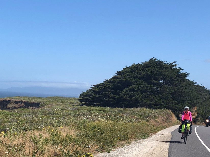
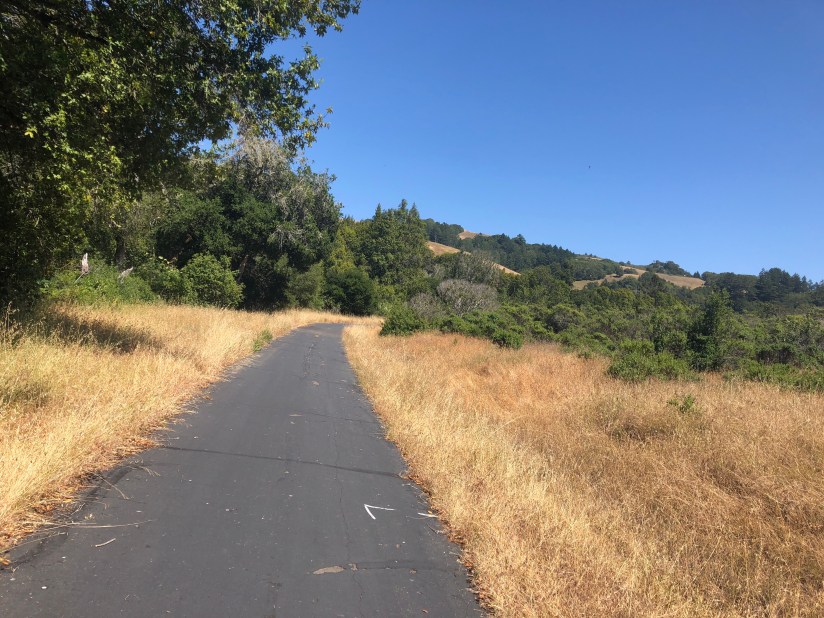
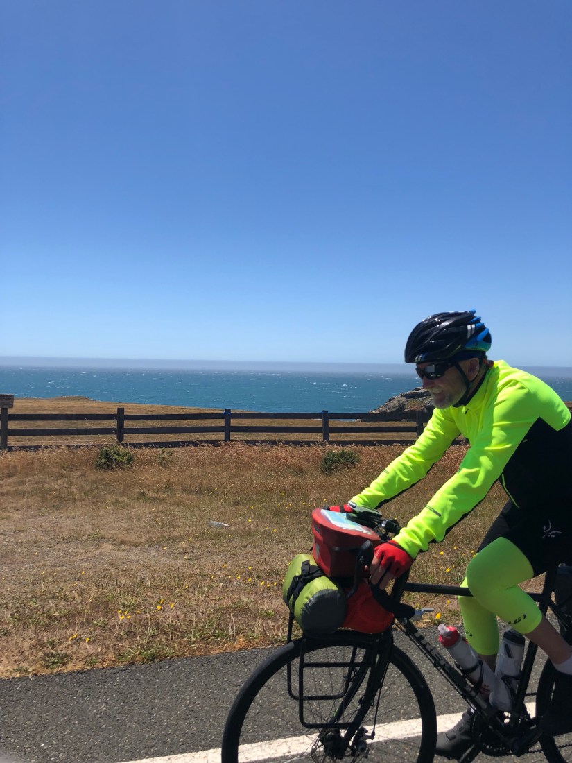
Our own day started with the free motel breakfast in Santa Cruz and retrieving our bikes from the storage closet to repack them and roll back out on the road for this 25th day of our tour by a few minutes past 9am. It has turned sunny, or as sunny as the Central Coast usually gets, and the wind had quartered (or however the old salt sailors say it) so it was more of a sidewind than a headwind.

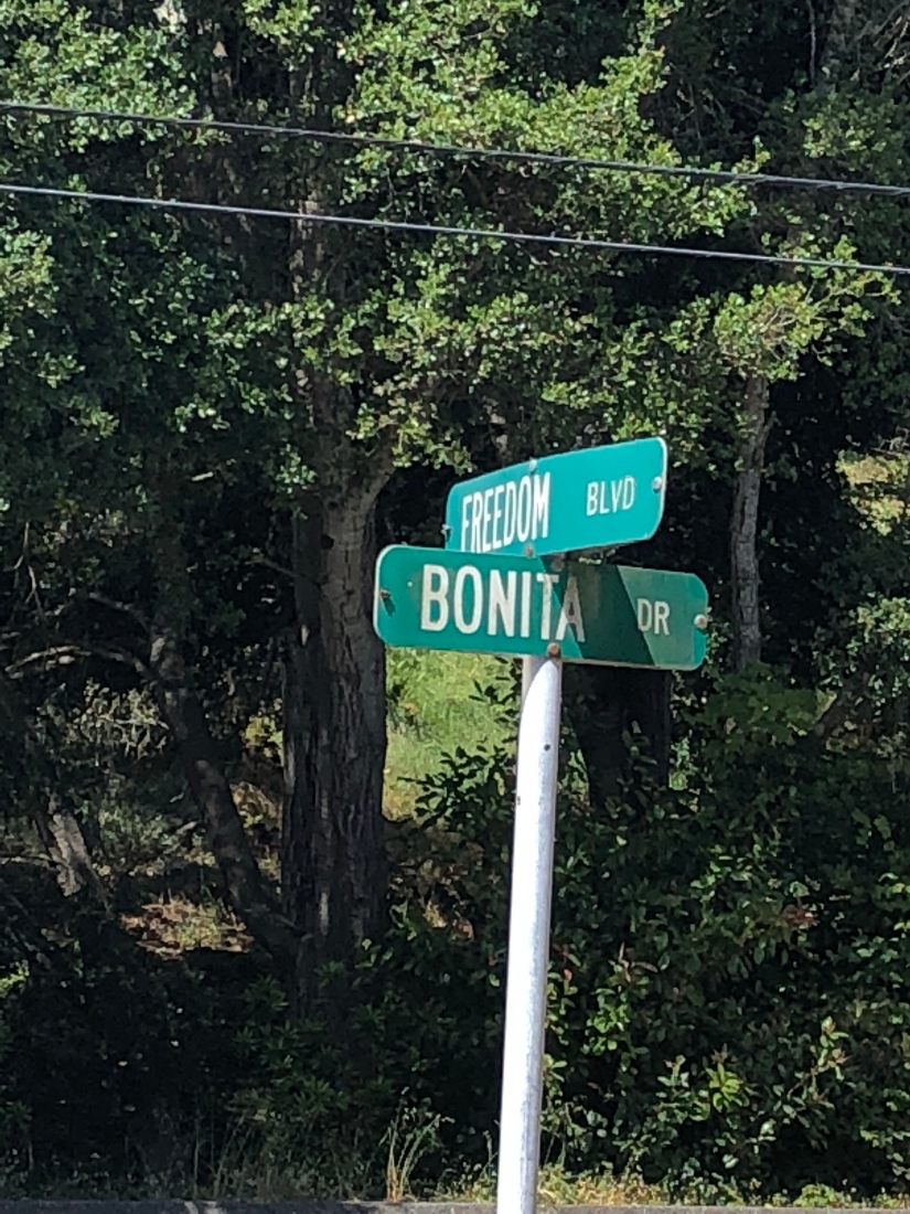
Ironically, it was on Freedom Blvd that Ashley had to stop and schedule an appointment with the dean. “This is my life now,” she lamented.

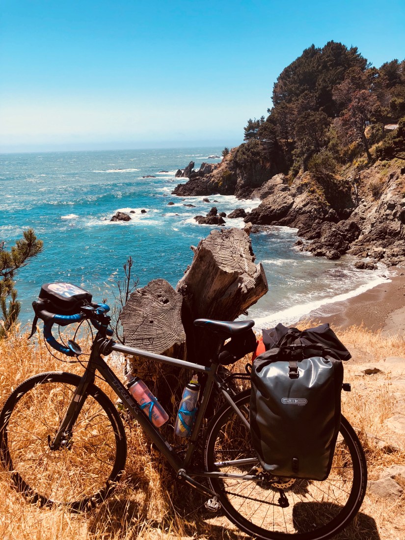
A quick stop in Aptos, nine miles later, so Ashley could mail her grandmother a birthday present and send home some stuff we forgot to give Winona & Sergio yesterday. Trying to lighten our loads! Next door to the PO was a discount sports equipment shop and we bought four new water bottles because, upon inspection this morning, our proved to be cultivating, to varying degrees, some kind of science project.

New water bottle!

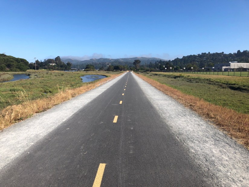
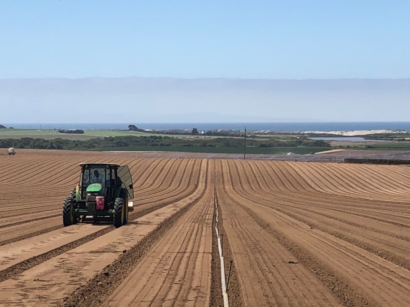
Ethel, our trusty robot navigator, steered us competently along Santa Cruz County bike lanes, paths, side and back streets to deposit us back on California 1 briefly before again detouring us on narrow and badly maintained farm roads through the strawberry fields of America, vast acreage plowed and planted with stoop crops — besides berries (“Strawberry Fields Forever”), there were artichokes, brussel sprouts, and lettuces — and picked by largely or entirely Hispanic fieldworkers. We could hear their norteƱo music blaring as we pedaled by, comparing our workday to theirs.

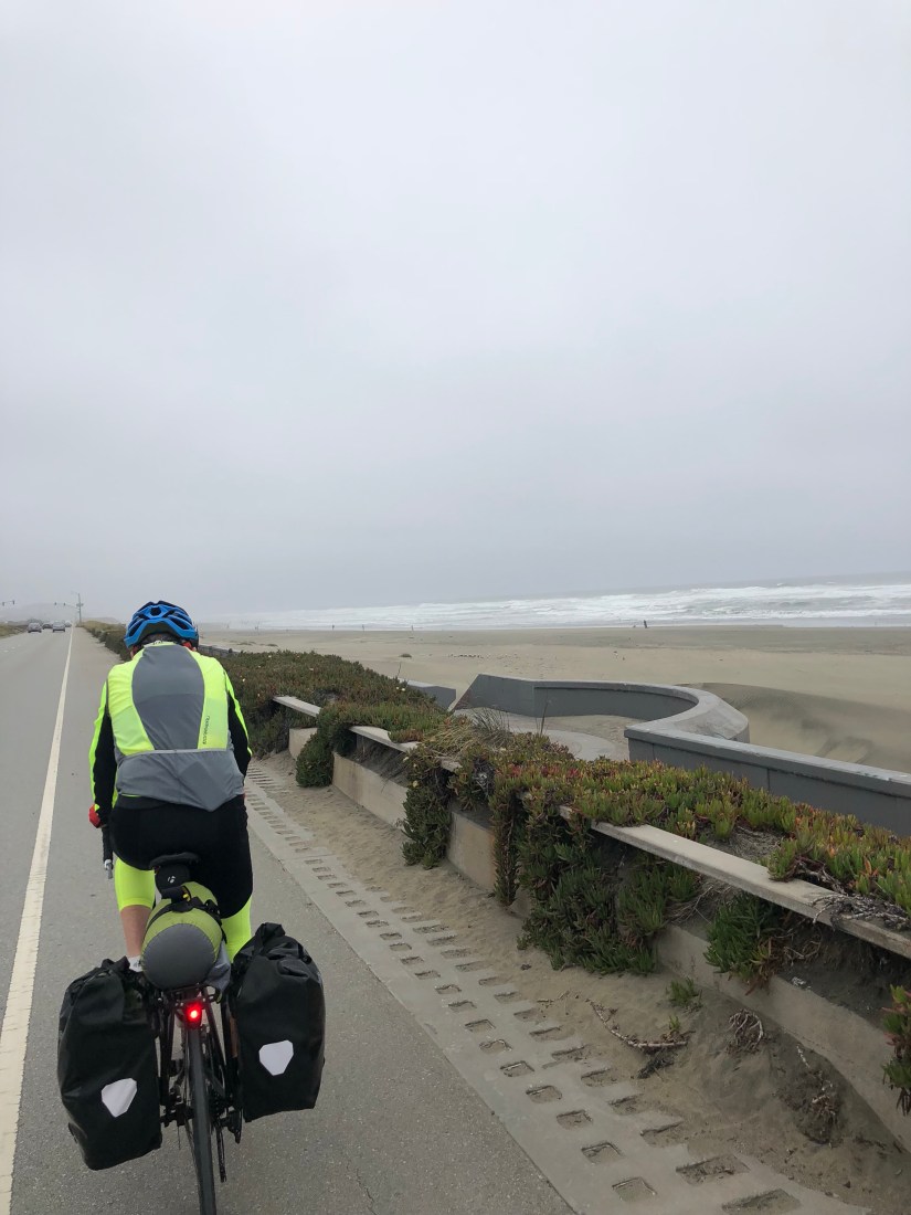
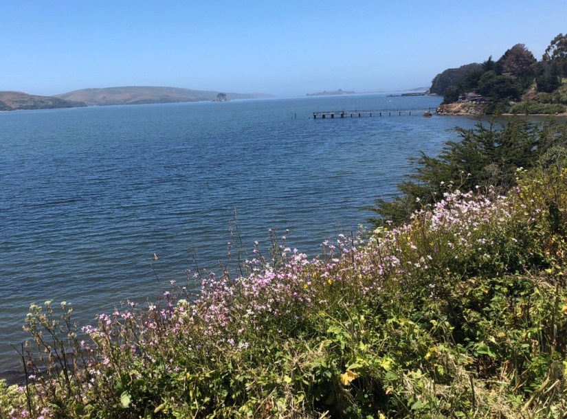
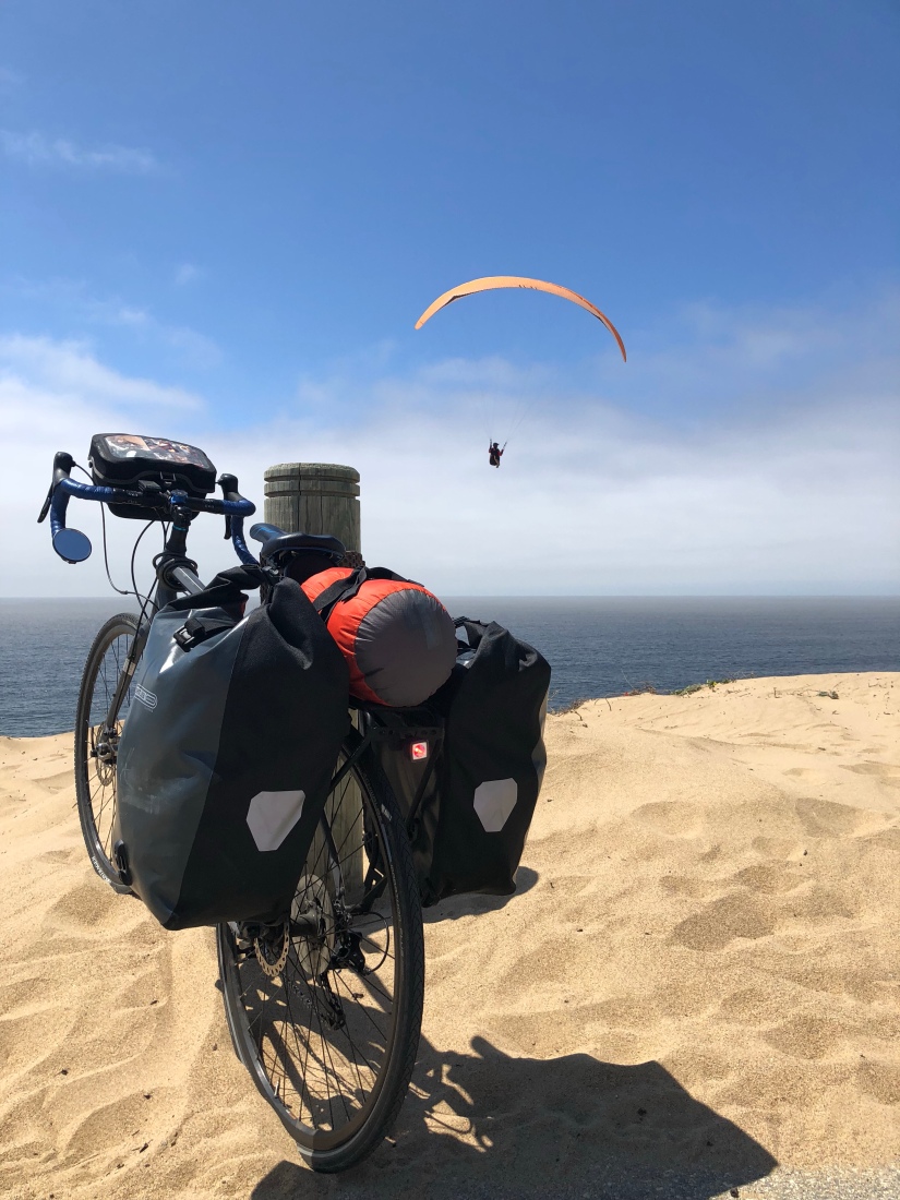
By a few miles north of Monterey, we gained a bicycle path which eventually mounted the dunes and gave us views of the bay, and of some paragliders riding the ocean breeze, before skirting the municipal beach park on a lovely path lined with eucalyptus trees.

As we climbed back through town to rejoin Hwy 1, we passed several old adobes, relics of Monterey’s early 19th-century role as capital of the Mexican province of Alta California, prior to the American invasion which seized the territory and made it part of the US (let’s never forget that).

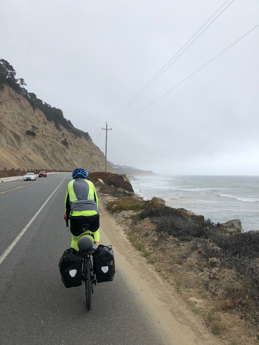
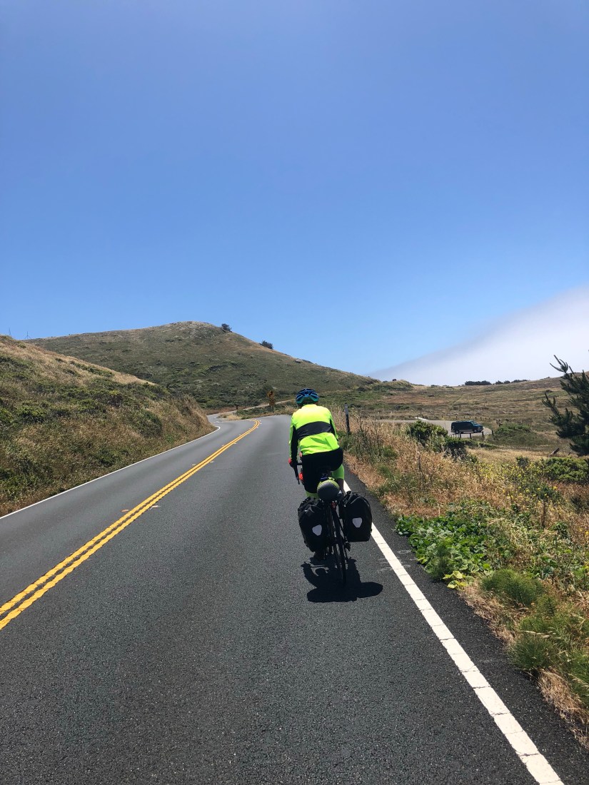
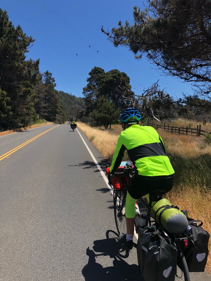
Hwy 1 between Monterey and Carmel proved a challenging ride, with narrow shoulders and a lot of traffic, though by now, 1300 miles into our trip, we’re equipped to handle it. Still, it’s never nice to be cut off by a Jaguar coupe, almost hit by a pickup impulsively changing lanes, and brushed a little too closely by a tractor-trailer.

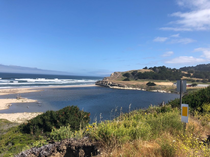
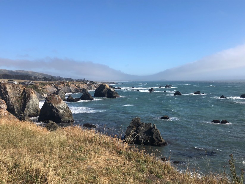
Fortunately after the southern turnoff to Pt. Lobos and 17-Mile Drive, the Cabrillo Highway, as 1 is known around here, regained its rural character and the southbound traffic, at least, lessened considerably.

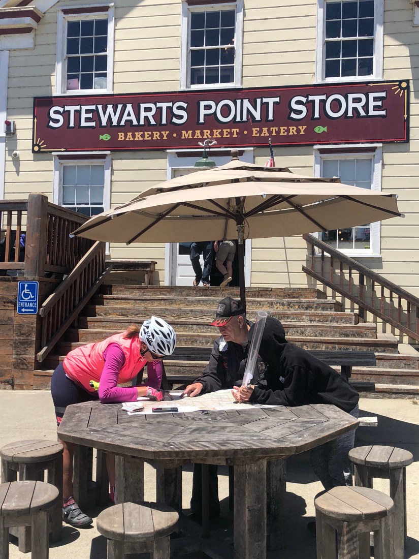
Carmel Highlands was our last service stop, our map warned us, for 21 miles (and 60% of the day’s climbing) until Big Sur. So we stopped at the one grocery store and bought water, Gatorade, and a turkey sandwich just in case. “We’ll probably end up throwing that away,” warned Ashley, and in fact we probably will. But better safe and well fed than stuck with a flat and hungry.

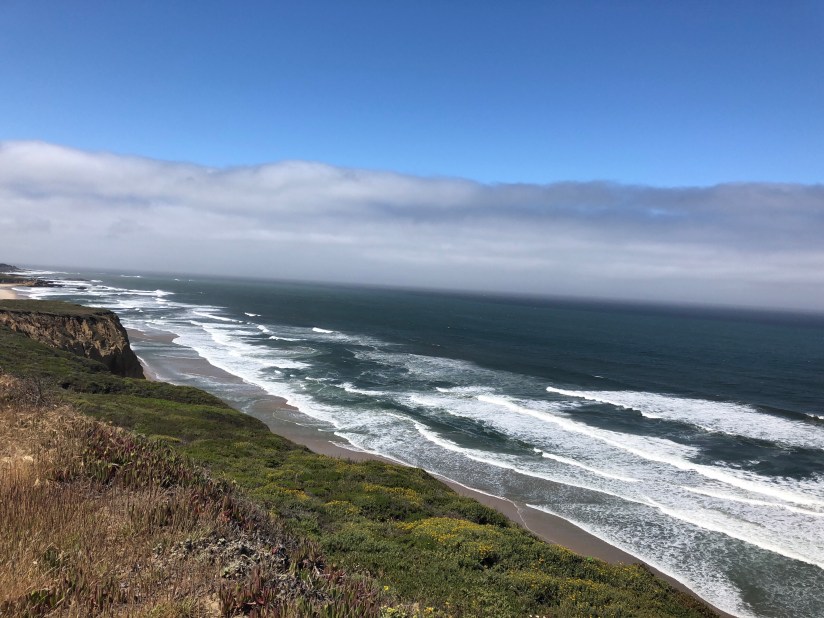
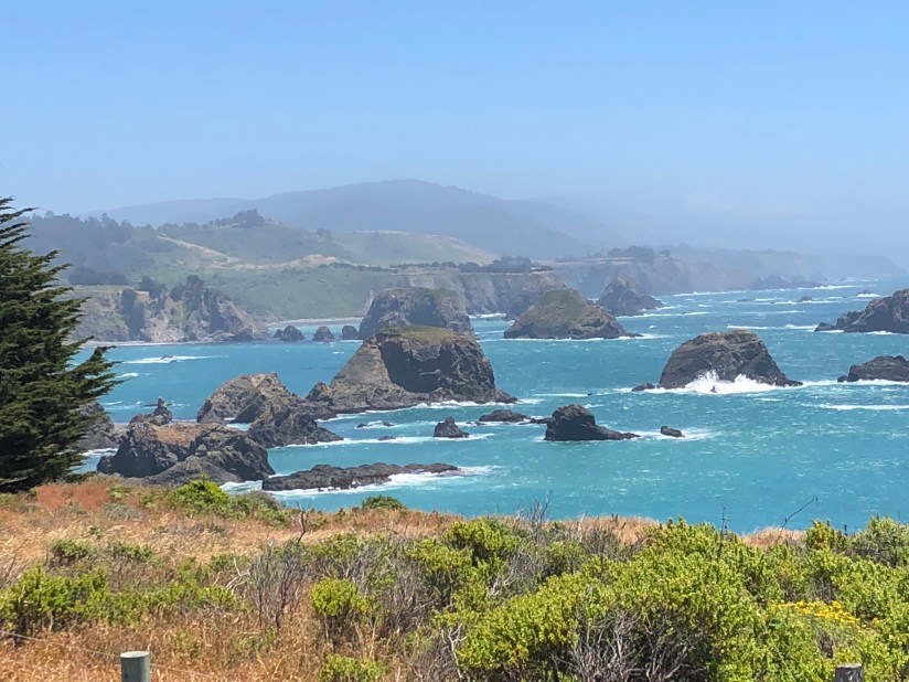
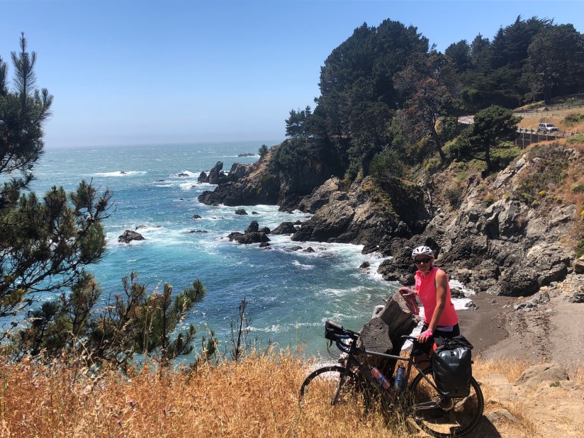
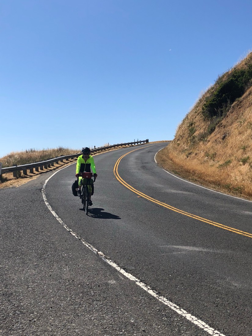
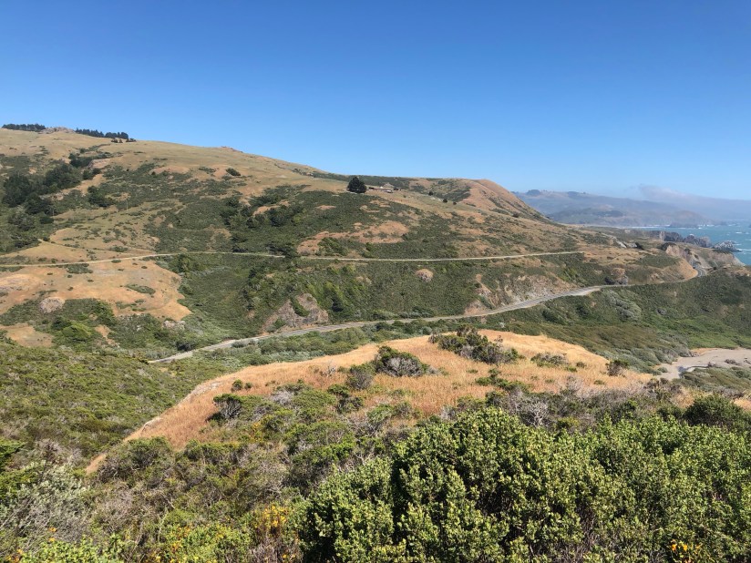
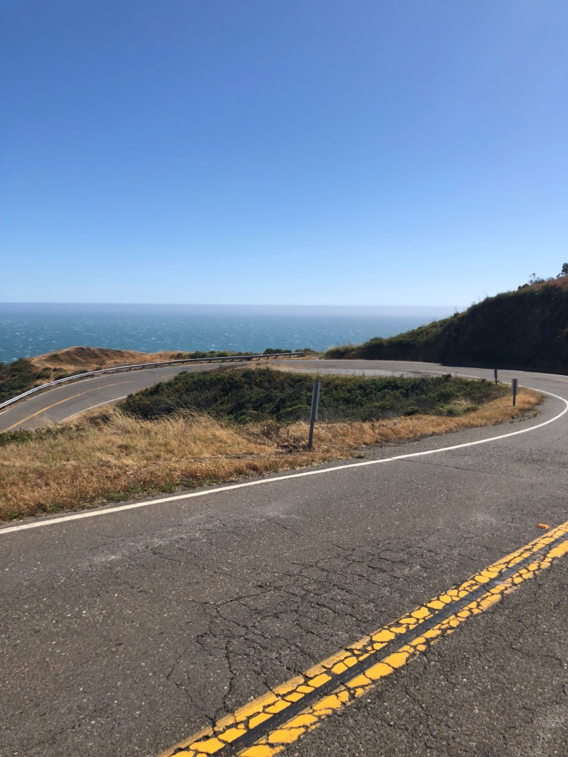
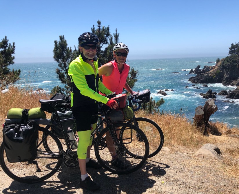
Very soon, climbing a series of short steep hills, we came into view of the Big Sur coastline. It was another 15 miles of splendor, climbing on a gentle grade with an occasional and sometimes windy descent, but all spectacular coastline leading up to and coming into the actual village of Big Sur. Southbound traffic, thanks to the road closure, was light to nonexistent.

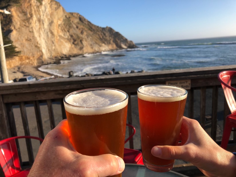
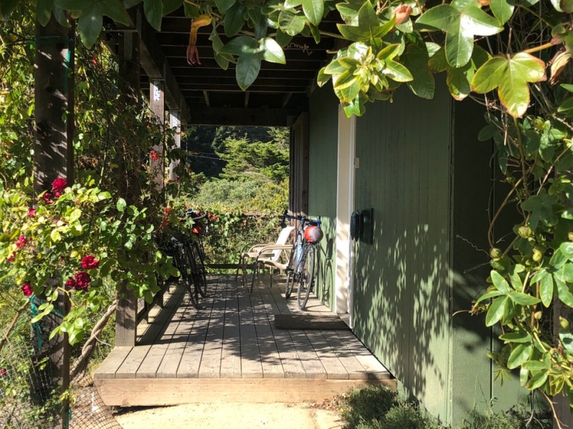
We stopped half a dozen times to take photos, and it was 6:45 when we got to our campground–we’d snagged the last site. We pitched our tent and walked five minutes to dinner at the Big Sur River Inn. Hoping for a decent sleep before a short but steep day tomorrow.


Today’s stats: 78.1 miles, 4433′ climbing, 6:45 riding time, plus the time it took to cross traffic lanes and take a lot of photos.

By the Wind Grieved

One of the reasons most tourists cycle north to south along the Pacific Coast is the prevailing northerly winds at your back. We experienced some headwind yesterday along the peninsula south of San Francisco, but today it blew again in this least advantageous of directions, slowing us to a crawl along the stretch of California 1 that rolls, with occasional steeper climbs, along the cliffs and down into beaches and coves, only to climb back up again to the bluff tops. Even when the road was level or less than steeply downhill, we had to pedal to make any headway, and pedaling our hearts out carried us no more than eight or nine miles per long hour.

Looks peaceful, but imagine a steady 15mph gusting to 20.

We got used to it, settling into our lowest gears, enjoying the views of sheer-walled drop-offs, craggy sea stacks, driftwood-strewn tidal pools, and wind-driven surf crashing on the rocky shore. Once in a while one of us whined, or shifted wearily in the saddle. As a distraction, we continued cataloguing roadside debris, the shredded and atomized fabric of Western civilization. New entries on our ongoing list included a kid’s car seat (no kid), some hose clamps, rubber surgical gloves, an empty packet of cyclists’ chamois cream, a pair of black eyeglass frames (no lenses), and leeks — one leek every 50 yards for almost a mile. We decided that some parent had gone shopping, put the grocery bags in the backseat with the kids, and told them there would be leeks for dinner.

Here comes the fog.

The Saturday traffic was steady, the state park beaches busy despite the cold (for us) breeze and California coastal fog that soon took over. We powered on past isolated homes, some of them seemingly luxurious if precariously perched where they must someday fall into the sea. But we passed no services, and began to wonder when we could refill our water bottles, which (under-caffeinated) we hadn’t topped off before leaving our Half Moon Bay B&B, which we left perhaps too precipitously to avoid the other guests gathered around the breakfast table, eating quiche and drinking coffee and trying to one-up one another with travel tales.

Pigeon Point Lighthouse. There’s a hostel there, 27 miles N of Santa Cruz.

The headwind blew sand into our eyes and mouths, and we needed water, but there was nothing–nothing–on our route until about 15 miles north of Santa Cruz, with one exception.

Drawn by the smell of smoked meat blown our way by the headwind, long before we saw the cheery green sign, we rolled into the Highway 1 Brewery just after noon; it’s a somewhat improbable brewery, with nothing else around but a service station, and not much to look at. But it’s a friendly spot, with good grub, and after some warming comfort food and two cokes (no beer, of course), we felt well fueled for the last leg.

Next stop, thanks to our Santa Cruz friend Tom’s spot-on recommendation, was Swanton Berry Farm, for dessert: blackberry pie and boysenberry cheesecake. A quirky spot, very cozy, with an honor system for payment, and 10% off for bicyclists (“must wear helmets”).

The major climbing of the day had happened earlier, and the wind had shifted slightly to the west, or maybe our route bent to the southeast, so we cruised more easily into Santa Cruz after pie, arriving at the Fairfield Inn and Suites, on the northern edge of town, at 3:30.

Hot on our heels were Winona and Sergio, down from Reno for Father’s Day weekend with a resupply of snacks, clean clothing, mail, and a new credit card (David’s had been hacked and used to buy hot dogs and auto parts in Illinois). Their bike racks meant we could more easily take our Treks to one of the many local shops for checkups and adjustments. (NB: there are more bicycle shops in Santa Cruz than Starbuck’s.)

Happy Father’s Day!

Tom joined us and we repaired down the street to Humble Sea Brewing Co. for a drink, then to West End Taps for a festive dinner.

First of the day at Humble Sea.

Nightcaps were at the very interesting Pour House, where a wristband grants you automated access (for which you pay by the ounce) to tastes of 50 different beers and a dozen wines.

Video: Sergio pours a taste.

Next day, our rest day, Tom had organized a Father’s Day brunch at Gabriella’s, where we were joined by surprise guests: his son Ian and stepson Zeph, over from Alameda. After a long, leisurely, delicious meal, Winona and Sergio ferried us back to the bike shop to collect Ashley’s ride, which had needed some adjustments. Then a tearful goodbye in the hotel lobby. We’re on our own again.

Zeph, David, Ian, Tom, Winona, Sergio

We spent the afternoon figuring out accommodations for the next two days, around Big Sur, a phase of our ride which is complicated by the 2017 mudslides that washed out part of the road, closing it north of Hearst Castle until later this summer. Luckily, Tom is coming to our rescue–on which more in a couple of days. After settling that, we Lyfted back into town, hit another brewpub, did some shopping for a few necessities, and had a hearty dinner in preparation for tomorrow.

Winona and Tom at Humble Sea

This has been a wonderful rest day, and surprisingly emotional. We miss Winona and Sergio, and 20 hours wasn’t enough. And we miss Tom, even though we’ll see him again in a couple of days. But we’ve got our eyes on Big Sur and beyond: Southern California, here we come.


Saturday stats: 47.2 miles; 2587′ climbed; 4:28 riding time.

Open up that Golden Gate …

Despite all the beer, red wine, moscato and port we swilled last night at the Italian restaurant with our friend Jan, we were out of the room by 8 am or a little past. We had to wait several minutes to get across the four lanes of traffic and back to the bike path. Cold and windy—50s and 10-15 mph SSW ocean breeze—conditions that for once didn’t change throughout the day. As Mark Twain said, no colder winter there is than a summer in San Francisco. Stopped in Sausalito for a quick breakfast at the Bayside Cafe, and then we made our way to the Golden Gate Bridge.

Getting to the bridge was the hardest work of the day, a steep winding uphill to a bustling parking lot. For reasons still mysterious to us, bicyclists can only ride on the east side of the bridge certain hours of the day. Since we were on the west side, we had to carry the (loaded) bikes down 8-10 stairs, then walk under the bridge, then carry them back up (somehow it was double the number of steps going up).

And then, already whacked, we crossed the bridge. It was chilly, with a strong headwind, and chaotic: lots of pedestrians, including of course the clueless ones who walk on the bike side of the narrow shared path or step backwards in front of you. And other cyclists, both Lycra-clad guys and gals, as well as giant groups of wobbly two-wheeling tourists on rent-a-bikes.

After crossing the bridge, Ethel (our Garmin) dutifully navigated us through San Francisco on a route that included (mirabile dictu) almost no climbing and very little traffic. We wound through the Presidio, rolled down Arguello Street, then rode past the museums, gardens, and eucalyptus groves of Golden Gate Park all the way out west to the Great Highway.

There, along this always foggy and windy four-lane beach boulevard, the shoulder has drifted over with sand, forcing us sometimes into the busy road, as the headwind remained a relentless 10-15 mph.

Unbelievably, there were people on the beach. In shorts and T-shirts. Some wading. Others BBQing.

She was too close, that’s all. Didn’t wait or swing out in the other (unoccupied) lane. There may have been a hand gesture involved.

We stopped for lunch just north of Pacifica, at yet another Subway. We’d meant to go a little farther, but we were cold and hungry and eager to get done for the day, and Subway is fast and cheap and good enough. From there, it was an easy, mostly rolling 17 miles or so along Hwy 1 and some side roads to Half Moon Bay, A little too much traffic, but that’s OK. And a tunnel, actually some of the best riding along the entire stretch. (It was the warmest and safest we felt all day.)

The metaphorical light at the end of the tunnel.

The final few miles weren’t bad either, along a beachside bike path.

We checked into our B&B in Half Moon Bay at 4, ditched our bikes and bags, and Lyfted 20 miles east to the Stanford University hospital, where our friend Doug is undergoing a stem cell transplant.

Stats for today: 43.5 miles, 2556′ of up-and -up, in 4 hours 37 minutes. Doug’s white blood cell count = 0.1.

Running on Empty

Today was a difficult day. The conditions were mostly excellent: minimal traffic, lots of sunshine, warm but not hot. A bit of headwind but nothing like yesterday. And it was pretty easy riding: rolling hills, nothing too long or steep, only 62 miles. But we discovered very early on that our legs—as the German Kristof would say—are killed. Especially the first twenty and the last dozen or so miles were pure will. We were just out of gas.

We were slow leaving Bodega Bay, partly because we were trying to sort out accommodations and social arrangements for the next few days, which are all about connecting with friends and family in Marin, Palo Alto, and Santa Cruz. Settling on a Marin hotel was tricky: every hotel is either prohibitively expensive, or reviews suggest that you’re likely to be murdered there. (We finally decided to take a chance on an econo place, the America’s Best Value Inn/Mill Valley, which turned out to be awesome— newly renovated and a real bargain, $100 less than the better-known chain across the boulevard.)

We had juice and fig newtons in the room, then rode roughly 9 miles to the Estero Cafe in Valley Ford. The food was underwhelming, but the outdoor seating was nice, and we ran into Kristof yet again. He introduced us to another tourist, Michael, who came over from Singapore to ride the route we’re doing. Kristof took off, but Michael joined us. Cheerful guy, carrying a massive pile of stuff on the same model Trek 520 David is riding; he plans to come back and ride across the country. While we were there another solo tourist arrived, a young guy named Peter (a recent college grad, we speculated). He’s riding from his home in Boulder all the way to Anchorage (ā€œI wanted something really epic,ā€ he said). He’s on a carbon road bike carrying an enormous backpack, which seems terrible to us, especially given the fierce headwinds he has been and will continue to be fighting — but he’s made it this far, so it seems to be working. Hanging out with those guys over brunch, sharing stories and talking about routes, was the highlight of the riding day.

From there it was rolling hills, still on Highway 1 though it felt a little more rural: today we worked our way inland away from the coast. For a long time it was farmland, more cows than cars, which is fine by us, except for the flies and occasionally rutted pavement.

After lunch, we cycled along Tomales Bay, and there wasn’t much in the way of services for a while, except for the occasional oyster bar.

Just up and down endless rolling hills until we caught a bike path through the Samuel P. Taylor State Park, a sudden transition from California golden grasslands and mixed oak back to shady redwood groves — not the giants of the Humboldt, but huge by everyday tree standards.

The Cross Marin bike path dropped us off in the little forested crossroads of Lagunitas, where at a corner grocery we finally got a sandwich and more water. From there it was 20 miles along Sir Francis Drake Boulevard and some smaller roads parallel to it, flat-ish until the end, threading a maze of increasingly upscale suburban towns: Woodacre, Fairfax, San Anselmo, Ross, Kentfield, Larkspur, Corte Madera. Think Range Rovers with “Save the Whales” stickers, sun-hatted gym-toned dowagers walking poodles, organic cafefuls of preppies in shorts and Ralph Lauren dress shirts, storefront meditation centers, cheese- and wine-tasting rooms, and side street after side street of high-end homes with a Mercedes in the driveway, 2.5 perfect children, and impeccably tended landscaping.

Riding through Marin was tedious: every Porsche-driving yuppie was manifestly impatient with having to get around a couple of grubby bike tourists. Ā When one irritated lady in a gigantic BMW brushed by David a little too closely, Ashley almost chased her down (ā€œwhat, are you late for hot yoga?ā€). We decided we don’t love Marin (thinking of a preppy princess character in Parks & Rec, we’ve dubbed it Marinnifer).

The flat, bustling urban roads turned abruptly into a steep climb out of Corte Madera, up and over the winding and wooded Camino Alto, being passed by Lycra-clad road bikers as if we were standing still, but then a thrilling 30-mph descent into Mill Valley, where we picked up a broad freeway-like bike trail, the so-called Mill Valley/Sausalito Multiuse Pathway, that dropped us off a block from our motel (although the six lanes of traffic and lack of pedestrian crosswalks temporarily bamboozled us; fried as we were, we couldn’t spot it, until a helpful passerby set us straight). At this point we rejoined Hwy 1 at its intersection with long-lost Hwy 101, which meant a mad dash across 1, a virtual freeway, to the America’s Best Value Inn parking lot.

The Mill Valley/Sausalito Multiuse Pathway, part of the 500-mile San Francisco Bay Trail

Showered and changed, we welcomed our good friend Jan, over from San Rafael, who drove us across the street (really — it’s safer that way than walking) for a festive Italian dinner.

Tomorrow: the Golden Gate, SF, and Half Moon Bay!


Today by the numbers: 61.7 miles, 3326′, five hours and 17 minutes.

Two days on 1

Tuesday, Day 19. Because we knew today would be a short one, just under 50 miles, we enjoyed a relatively leisurely morning. Slept in a bit, then walked to the nearby Cafe One for breakfast. A very NorCal menu, organic, heavy on veggies; the so-called ā€œhippie (loaded) potatoesā€ and the “hippie scramble” were solid. Lingered there working on the blog for the day before and writing postcards and Father’s Day cards. Ā Catching up a bit.

Walked back to our motel, the Oceanside Inn. Econo and basic but clean and decent and run by a very friendly South Asian man and his bad-cop wife, who evicted us from the room at 11am, checkout time, with a loud knocking and a curtly shouted “eleven o’clock!” Fortunately we were already packed up and rolled out into the cool, foggy morning on Ft. Bragg’s Main Street.

About three-tenths of a mile in, we passed the North Coast Brewery gift shop, which had a rack of clothes—including bike jerseys—out front. Ashley spied a sign on the rack, unreadable at a distance but likely indicating a sale, so we turned around. The bike jerseys were indeed being peddled at a deep discount, so Ashley couldn’t resist. Ain’t no swag better than beer-bike swag.

We rode south over gentle hills a few miles, detouring slightly to see (precious) Mendocino, then rejoined Highway 1. The ride was uneventful but spectacular: the coastal views are breathtakingly gorgeous.

We stopped in Elk for lunch at an overpriced but adorable local market, which included a loo with a view.

Right after lunch, rather unexpectedly, we hit the fiercest climb of the day, 10-12% at its steepest, looping northwest at one point into the 14-20 mph headwind. It wasn’t long, but it was a few intense switchbacks and it definitely raised our heart rates. Highway 1 is like that: relentless, punishing short climbs, followed by some smooth easy pedaling along a grassy oak-dotted bluff, followed again by exhilarating winding descents into coves, creek bottoms and river mouths that make you want to climb again, just for more of that thrill. And climb you will.

Note fog bank looming on the right.

Pulled into Point Arena around 5:30 PM. As the little town of bars, restaurants, art galleries, New Age healing supplies, and vacation rental agents unrolled along a steep descent, we paused to map our lodging’s location and to our horror discovered that we’d accidentally booked a room in Gualala, 14 miles and a few climbs further south. Fortunately Hotels.com came to the rescue, via a very helpful agent who sounded as if he was in India but despite the distance managed to cancel our non-cancelable reservation and book us a room in the actual town we were in, which turned out to be a mile off route down to a little cove and then a hideously (and heartbreakingly) steep but very short ride up to the lobby check-in.

Room was very comfy for a slightly inflated price but featured a jacuzzi and a restaurant/tap room a few minutes’ walk away with a lovely evening coveside view, a great beer list, acceptable food, and indifferent service, which however we tolerated in our happy post-ride mellow mood.


Stats for today: 47.7 miles, 3440′ in 3:53.


Wednesday, Day 20. After downing a couple of buttery, syrupy waffles in the Wharf Master’s Inn breakfast room and pocketing some peanut butter packets for riding snacks, we carted our bikes and gear down the two flights of stairs and took off around 9:30. Rode the mile or so back into town, where we caught Highway 1 again—and we were on that spectacular road all day long.

First stop was Gualala, a dozen miles into the ride. Already peckish again, we had a makeshift lunch from the friendly Surf Market—V8, nuts, cheese, deviled eggs, hummus. A local firefighter visited for a few minutes to compliment us on our hi-viz bike jerseys, flourescent knee warmers and flashing tail lights. We saw some backpackers headed north, one with a cat on a leash(!).

Another dozen miles in we stopped again, at the Stewart’s Point market, ostensibly to pee and get water, but naturally we were tempted by treats: a raspberry pie brownie (David) and a chocolate milkshake (Ashley). We sat outside on sunny benches talking to another pair of tourists, a Seattle couple riding from home to Palo Alto to watch their son graduate from Stanford. Turns out that Cliff and Nelda had camped one night near Mike and Christina, the father-daughter duo we met in Rio Dell, and last night with our German friend Kristof, for whom they had made dinner. There’s something very heartwarming about these connections: bike tourists who share a highway for a few days or a couple of weeks form a kind of temporary family, or at least a little network of temporary friends. After lunch, Kristof pedaled by us once more, hastening to catch the Seattle couple to give them his email address.

Getting passed, once again, by Kristof in his tennis shoes.

We also met a few other travelers while sitting outside the market. One was a gruff-looking but sweet-natured older motorcyclist wearing tattered Carharts and opining about those who drive too fast on the road: ā€œon any California rode you have to expect to come across bicyclists,ā€ he said, and he was clearly mystified by those too impatient or too reckless to slow down and enjoy this beautiful place.

Then we met a retired man and his grandson, whom we’d seen leaving Gualala. They were riding a motorcycle and carrying a little trailer, meandering with deliberate slowness from Idaho to Texas, where the boy—thirteen years old—would return home to his parents, having spent a month seeing 11 states with his granddad. The kid was surprisingly into the trip, seemingly aware of the incredible opportunity he was being given. His granddad, a cheerful and enthusiastic talker, explained that from Texas he’d carry on until September; he unrolled a map of the US with his route laid out with great precision.

He’d cover all 48 states in the continental US, taking his time, seeing memorials and historically significant sites, chatting with locals, and fraternizing with fellow passersby on the patios of little markets in small not-quite-even-towns all across the country. This chap, whose name we never got, was a delight and an inspiration. We all left at the same time; he waved a big wave as he disappeared over a hill we were climbing a little more slowly.

Fort Ross, early 19th-century Imperial Russian outpost north of Jenner.

The other highlight of the day was the road itself, the endlessly interesting and dynamic Highway 1. There’s a reason this is widely regarded as one of the great road trips in the world, a bucket list journey, 655 miles of mostly splendor. It’s even better, we think, on a bike. There are no huge climbs, just one after another, each a little different. The engineers who designed and built this epic expressway created a thing of beauty, and even when one is humping a heavy bike up a steeper stretch it’s hard not to be a little amazed.

The thrilling winding dips, the sharp turns that become new climbs, the long knuckle-whitening descents are spectacular. And all the while you’re playing peek-a-boo with the Pacific. Southern California gets a lot of love, but the north coast is a marvel. The coastline is indescribable; we hope our pictures will do it some justice.

You have to imagine the shadows of circling hawks, the calling of doves, the crashing surf, and the accompanying smells of the sea, of spicy eucalyptus trees, and that winelike tang of dry yellow grassy California , all swirling in the roar of the coastal breeze.

It was another beautiful day, blue skies forever, the Pacific fog bank keeping well offshore, a perfect temperature. It was windy, though, and the wind picked up as the day went on. A tailwind blew us along, and as the road twisted a headwind more than a few times all but stopped us in our tracks (always, of course, while climbing), and occasionally a sidewind rocked us and our bikes back and forth on the road.

After countless ups and downs, we finally arrived in Bodega Bay (where Hitchcock’s The Birds was set), our stop for the night.

Checked into the very beautiful Bodega Bay Inn and set out walking the shoulder of Hwy 1 into the town of Bodega Bay, once again in search of seafood and ale.


Stats for today: 63.1 miles, 4,549’ of climbing, four hours and 56 minutes.